You are here: Home > Network List > US - United States National Seismic Network Stations List
> Station ELK Elko, Nevada, USA > Earthquake Result Viewer
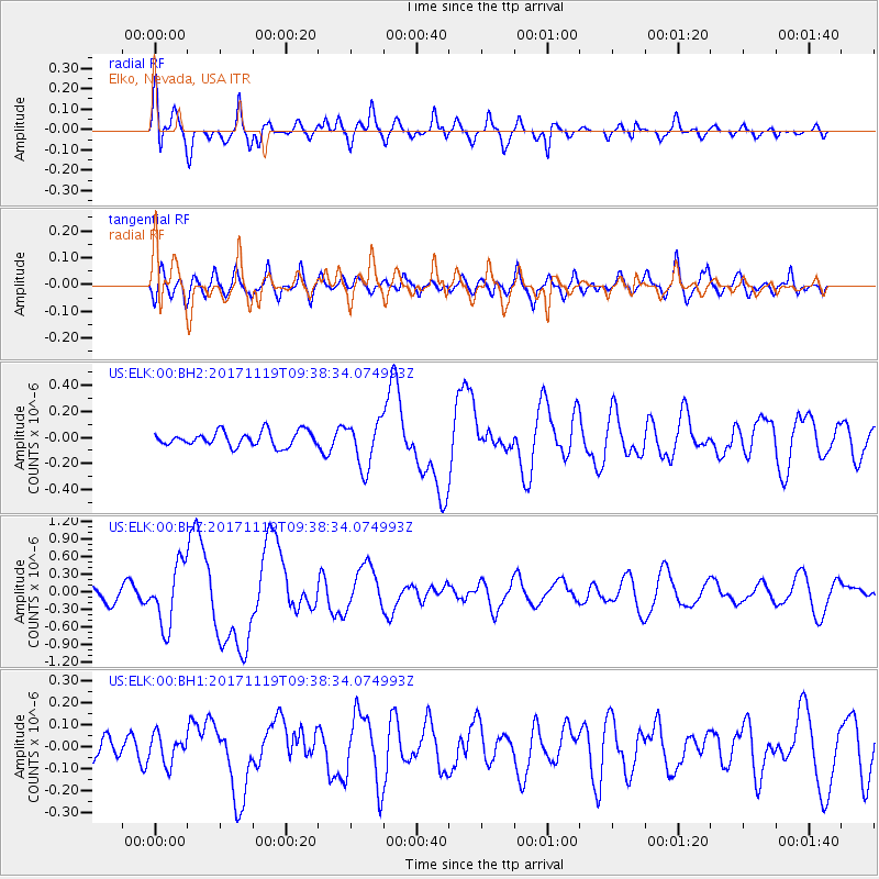
ELK Elko, Nevada, USA - Earthquake Result Viewer
*The percent match for this event was below the threshold and hence no stack was calculated.
| Earthquake location: |
Loyalty Islands |
| Earthquake latitude/longitude: |
-21.7/168.7 |
| Earthquake time(UTC): |
2017/11/19 (323) 09:25:47 GMT |
| Earthquake Depth: |
4.0 km |
| Earthquake Magnitude: |
6.3 mww |
| Earthquake Catalog/Contributor: |
NEIC PDE/us |
|
| Network: |
US United States National Seismic Network |
| Station: |
ELK Elko, Nevada, USA |
| Lat/Lon: |
40.74 N/115.24 W |
| Elevation: |
2210 m |
|
| Distance: |
93.9 deg |
| Az: |
47.658 deg |
| Baz: |
244.823 deg |
| Ray Param: |
$rayparam |
*The percent match for this event was below the threshold and hence was not used in the summary stack. |
|
| Radial Match: |
66.467445 % |
| Radial Bump: |
400 |
| Transverse Match: |
50.18919 % |
| Transverse Bump: |
400 |
| SOD ConfigId: |
2429771 |
| Insert Time: |
2017-12-03 09:27:45.195 +0000 |
| GWidth: |
2.5 |
| Max Bumps: |
400 |
| Tol: |
0.001 |
|
Signal To Noise
| Channel | StoN | STA | LTA |
| US:ELK:00:BHZ:20171119T09:38:34.074993Z | 4.337964 | 5.185013E-7 | 1.195264E-7 |
| US:ELK:00:BH1:20171119T09:38:34.074993Z | 0.86693484 | 6.485329E-8 | 7.4807566E-8 |
| US:ELK:00:BH2:20171119T09:38:34.074993Z | 3.1379468 | 1.7687027E-7 | 5.636497E-8 |
| Arrivals |
| Ps | |
| PpPs | |
| PsPs/PpSs | |


