You are here: Home > Network List > US - United States National Seismic Network Stations List
> Station WUAZ Wupatki, Arizona, USA > Earthquake Result Viewer
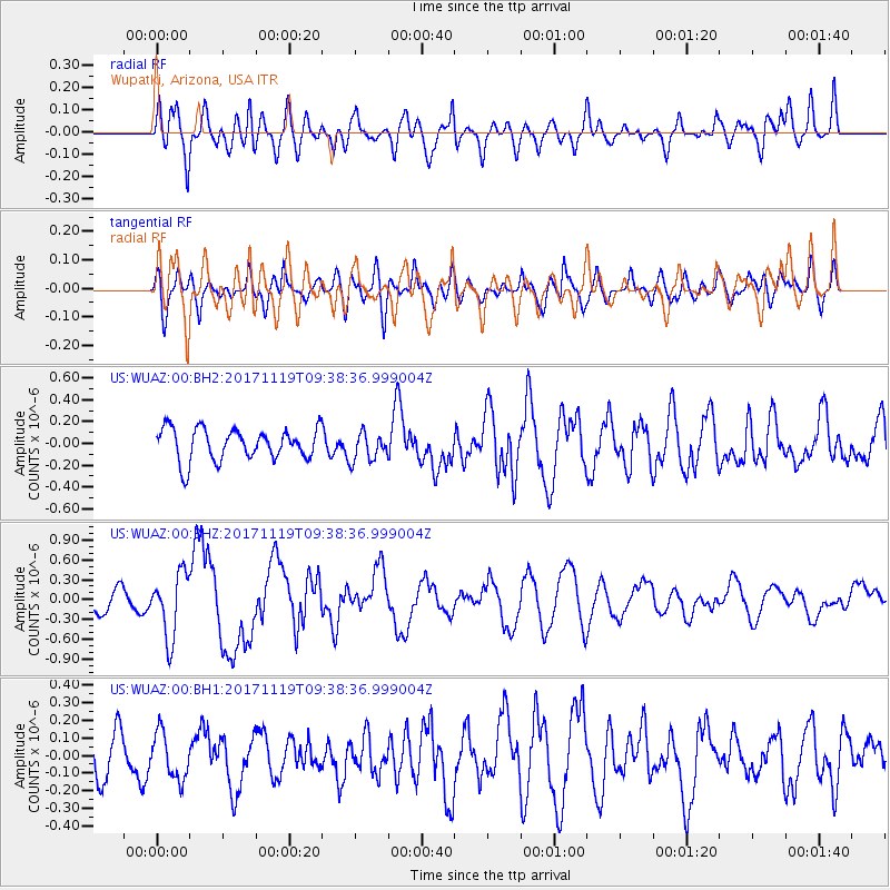
WUAZ Wupatki, Arizona, USA - Earthquake Result Viewer
*The percent match for this event was below the threshold and hence no stack was calculated.
| Earthquake location: |
Loyalty Islands |
| Earthquake latitude/longitude: |
-21.7/168.7 |
| Earthquake time(UTC): |
2017/11/19 (323) 09:25:47 GMT |
| Earthquake Depth: |
4.0 km |
| Earthquake Magnitude: |
6.3 mww |
| Earthquake Catalog/Contributor: |
NEIC PDE/us |
|
| Network: |
US United States National Seismic Network |
| Station: |
WUAZ Wupatki, Arizona, USA |
| Lat/Lon: |
35.52 N/111.37 W |
| Elevation: |
1592 m |
|
| Distance: |
94.6 deg |
| Az: |
53.683 deg |
| Baz: |
246.757 deg |
| Ray Param: |
$rayparam |
*The percent match for this event was below the threshold and hence was not used in the summary stack. |
|
| Radial Match: |
60.212307 % |
| Radial Bump: |
400 |
| Transverse Match: |
63.33754 % |
| Transverse Bump: |
400 |
| SOD ConfigId: |
2429771 |
| Insert Time: |
2017-12-03 09:27:55.956 +0000 |
| GWidth: |
2.5 |
| Max Bumps: |
400 |
| Tol: |
0.001 |
|
Signal To Noise
| Channel | StoN | STA | LTA |
| US:WUAZ:00:BHZ:20171119T09:38:36.999004Z | 3.3675354 | 4.832006E-7 | 1.4348792E-7 |
| US:WUAZ:00:BH1:20171119T09:38:36.999004Z | 1.1290956 | 1.3200095E-7 | 1.16908566E-7 |
| US:WUAZ:00:BH2:20171119T09:38:36.999004Z | 0.90961975 | 1.3154283E-7 | 1.44613E-7 |
| Arrivals |
| Ps | |
| PpPs | |
| PsPs/PpSs | |


