You are here: Home > Network List > AV - Alaska Volcano Observatory Stations List
> Station SPCR Ckakachatna River, Mount Spurr, Alaska > Earthquake Result Viewer
SPCR Ckakachatna River, Mount Spurr, Alaska - Earthquake Result Viewer
*The percent match for this event was below the threshold and hence no stack was calculated.
| Earthquake location: |
Northeast Of Taiwan |
| Earthquake latitude/longitude: |
25.7/124.0 |
| Earthquake time(UTC): |
2021/05/03 (123) 05:07:29 GMT |
| Earthquake Depth: |
189 km |
| Earthquake Magnitude: |
5.5 Mww |
| Earthquake Catalog/Contributor: |
NEIC PDE/us |
|
| Network: |
AV Alaska Volcano Observatory |
| Station: |
SPCR Ckakachatna River, Mount Spurr, Alaska |
| Lat/Lon: |
61.20 N/152.21 W |
| Elevation: |
984 m |
|
| Distance: |
64.9 deg |
| Az: |
32.126 deg |
| Baz: |
277.883 deg |
| Ray Param: |
$rayparam |
*The percent match for this event was below the threshold and hence was not used in the summary stack. |
|
| Radial Match: |
51.764202 % |
| Radial Bump: |
366 |
| Transverse Match: |
53.08575 % |
| Transverse Bump: |
400 |
| SOD ConfigId: |
24844331 |
| Insert Time: |
2021-05-17 05:13:18.994 +0000 |
| GWidth: |
2.5 |
| Max Bumps: |
400 |
| Tol: |
0.001 |
|
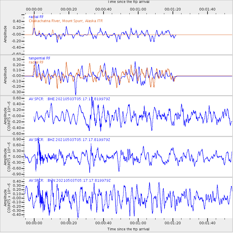
Signal To Noise
| Channel | StoN | STA | LTA |
| AV:SPCR: :BHZ:20210503T05:17:17.819979Z | 1.9234147 | 3.5000167E-7 | 1.819689E-7 |
| AV:SPCR: :BHN:20210503T05:17:17.819979Z | 1.0820622 | 1.7395932E-7 | 1.6076648E-7 |
| AV:SPCR: :BHE:20210503T05:17:17.819979Z | 2.1928585 | 3.1634224E-7 | 1.4426023E-7 |
| Arrivals |
| Ps | |
| PpPs | |
| PsPs/PpSs | |


