You are here: Home > Network List > US - United States National Seismic Network Stations List
> Station MSO Missoula, Montana, USA > Earthquake Result Viewer
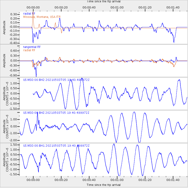
MSO Missoula, Montana, USA - Earthquake Result Viewer
*The percent match for this event was below the threshold and hence no stack was calculated.
| Earthquake location: |
Northeast Of Taiwan |
| Earthquake latitude/longitude: |
25.7/124.0 |
| Earthquake time(UTC): |
2021/05/03 (123) 05:07:29 GMT |
| Earthquake Depth: |
189 km |
| Earthquake Magnitude: |
5.5 Mww |
| Earthquake Catalog/Contributor: |
NEIC PDE/us |
|
| Network: |
US United States National Seismic Network |
| Station: |
MSO Missoula, Montana, USA |
| Lat/Lon: |
46.83 N/113.94 W |
| Elevation: |
1264 m |
|
| Distance: |
90.9 deg |
| Az: |
35.575 deg |
| Baz: |
310.16 deg |
| Ray Param: |
$rayparam |
*The percent match for this event was below the threshold and hence was not used in the summary stack. |
|
| Radial Match: |
26.83303 % |
| Radial Bump: |
400 |
| Transverse Match: |
93.27995 % |
| Transverse Bump: |
311 |
| SOD ConfigId: |
24844331 |
| Insert Time: |
2021-05-17 05:23:20.516 +0000 |
| GWidth: |
2.5 |
| Max Bumps: |
400 |
| Tol: |
0.001 |
|
Signal To Noise
| Channel | StoN | STA | LTA |
| US:MSO:00:BHZ:20210503T05:19:40.499972Z | 1.7150145 | 8.076102E-7 | 4.7090575E-7 |
| US:MSO:00:BH1:20210503T05:19:40.499972Z | 1.0672454 | 5.254383E-7 | 4.9233125E-7 |
| US:MSO:00:BH2:20210503T05:19:40.499972Z | 2.1229527 | 1.1412808E-6 | 5.375913E-7 |
| Arrivals |
| Ps | |
| PpPs | |
| PsPs/PpSs | |


