KENS XW.KENS - Earthquake Result Viewer
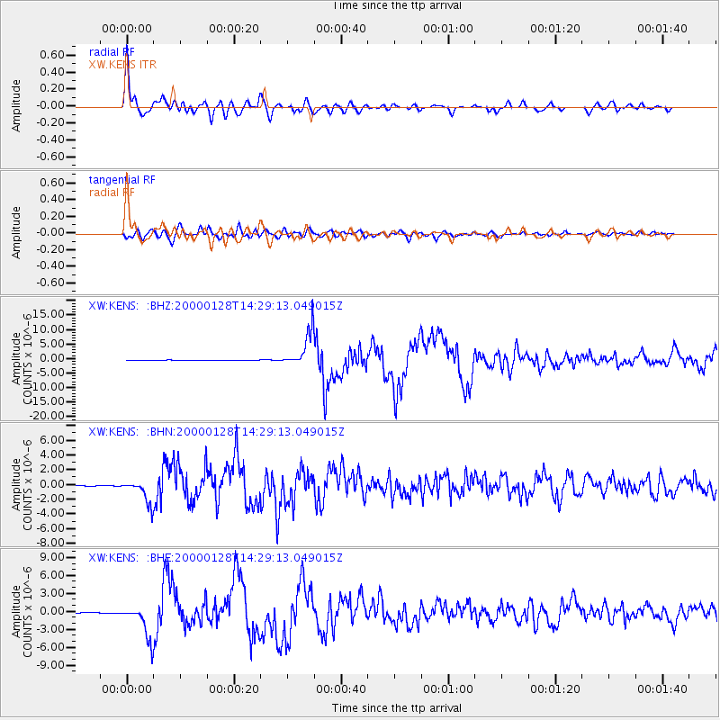
Earthquake location: Kuril Islands
Earthquake latitude/longitude: 43.0/146.8
Earthquake time(UTC): 2000/01/28 (028) 14:21:07 GMT
Earthquake Depth: 61 km
Earthquake Magnitude: 6.7 MB, 6.6 MS, 6.8 MW, 6.8 ME
Earthquake Catalog/Contributor: WHDF/NEIC
Network: XW Tien Shan Continental Dynamics
Station: KENS XW.KENS
Lat/Lon: 42.32 N/79.24 E
Elevation: 2805 m
Distance: 48.4 deg
Az: 293.598 deg
Baz: 64.932 deg
Ray Param: 0.0691817
Estimated Moho Depth: 64.25 km
Estimated Crust Vp/Vs: 1.61
Assumed Crust Vp: 6.306 km/s
Estimated Crust Vs: 3.923 km/s
Estimated Crust Poisson's Ratio: 0.18
Radial Match: 93.5386 %
Radial Bump: 400
Transverse Match: 77.18014 %
Transverse Bump: 400
SOD ConfigId: 20082
Insert Time: 2010-02-26 15:33:54.294 +0000
GWidth: 2.5
Max Bumps: 400
Tol: 0.001

Signal To Noise

ChannelStoNSTALTA
XW:KENS: :BHN:20000128T14:29:13.049015Z31.9753511.555486E-64.8646413E-8
XW:KENS: :BHE:20000128T14:29:13.049015Z36.3029562.8622135E-67.884244E-8
XW:KENS: :BHZ:20000128T14:29:13.049015Z158.492946.1785395E-63.898306E-8
Arrivals
Ps6.6 SECOND
PpPs25 SECOND
PsPs/PpSs32 SECOND