KENS XW.KENS - Earthquake Result Viewer
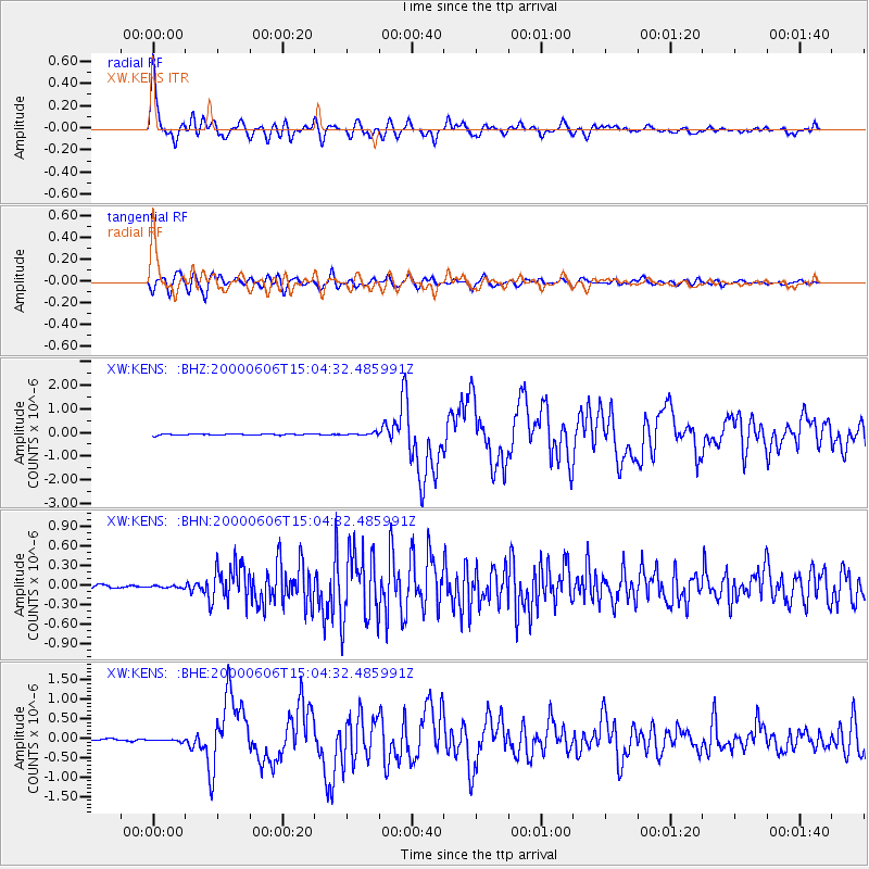
Earthquake location: Southeast Of Ryukyu Islands
Earthquake latitude/longitude: 29.4/131.4
Earthquake time(UTC): 2000/06/06 (158) 14:57:02 GMT
Earthquake Depth: 33 km
Earthquake Magnitude: 5.8 MB, 6.0 MS, 6.4 MW, 6.4 MW
Earthquake Catalog/Contributor: WHDF/NEIC
Network: XW Tien Shan Continental Dynamics
Station: KENS XW.KENS
Lat/Lon: 42.32 N/79.24 E
Elevation: 2805 m
Distance: 43.6 deg
Az: 301.779 deg
Baz: 89.694 deg
Ray Param: 0.072400406
Estimated Moho Depth: 51.0 km
Estimated Crust Vp/Vs: 1.69
Assumed Crust Vp: 6.306 km/s
Estimated Crust Vs: 3.731 km/s
Estimated Crust Poisson's Ratio: 0.23
Radial Match: 90.74849 %
Radial Bump: 400
Transverse Match: 77.770905 %
Transverse Bump: 400
SOD ConfigId: 3744
Insert Time: 2010-02-26 15:34:02.574 +0000
GWidth: 2.5
Max Bumps: 400
Tol: 0.001

Signal To Noise

ChannelStoNSTALTA
XW:KENS: :BHN:20000606T15:04:32.485991Z0.697159951.7308743E-82.4827507E-8
XW:KENS: :BHE:20000606T15:04:32.485991Z1.28506163.4737926E-82.703211E-8
XW:KENS: :BHZ:20000606T15:04:32.485991Z1.76109415.0146923E-82.8474869E-8
Arrivals
Ps6.0 SECOND
PpPs20 SECOND
PsPs/PpSs26 SECOND