You are here: Home > Network List > IU - Global Seismograph Network (GSN - IRIS/USGS) Stations List
> Station XMAS Kiritimati Island, Republic of Kiribati > Earthquake Result Viewer
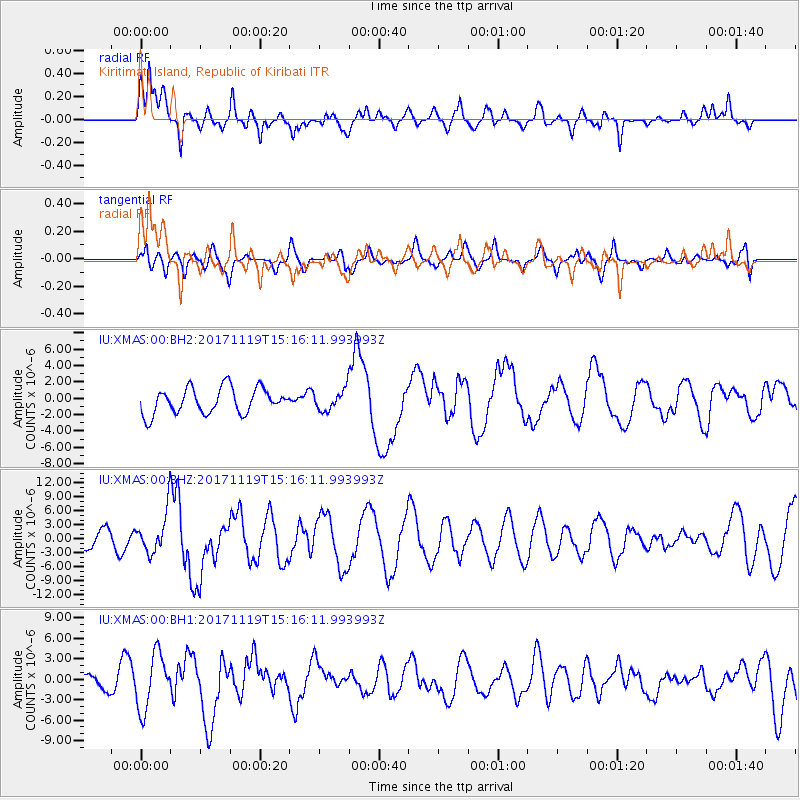
XMAS Kiritimati Island, Republic of Kiribati - Earthquake Result Viewer
*The percent match for this event was below the threshold and hence no stack was calculated.
| Earthquake location: |
Loyalty Islands |
| Earthquake latitude/longitude: |
-21.5/168.5 |
| Earthquake time(UTC): |
2017/11/19 (323) 15:09:03 GMT |
| Earthquake Depth: |
14 km |
| Earthquake Magnitude: |
6.6 mww |
| Earthquake Catalog/Contributor: |
NEIC PDE/us |
|
| Network: |
IU Global Seismograph Network (GSN - IRIS/USGS) |
| Station: |
XMAS Kiritimati Island, Republic of Kiribati |
| Lat/Lon: |
2.04 N/157.45 W |
| Elevation: |
20 m |
|
| Distance: |
40.7 deg |
| Az: |
59.061 deg |
| Baz: |
233.05 deg |
| Ray Param: |
$rayparam |
*The percent match for this event was below the threshold and hence was not used in the summary stack. |
|
| Radial Match: |
75.696365 % |
| Radial Bump: |
400 |
| Transverse Match: |
62.826153 % |
| Transverse Bump: |
400 |
| SOD ConfigId: |
2429771 |
| Insert Time: |
2017-12-03 15:10:28.655 +0000 |
| GWidth: |
2.5 |
| Max Bumps: |
400 |
| Tol: |
0.001 |
|
Signal To Noise
| Channel | StoN | STA | LTA |
| IU:XMAS:00:BHZ:20171119T15:16:11.993993Z | 1.7210166 | 4.3750456E-6 | 2.5421286E-6 |
| IU:XMAS:00:BH1:20171119T15:16:11.993993Z | 2.4536252 | 4.058705E-6 | 1.6541668E-6 |
| IU:XMAS:00:BH2:20171119T15:16:11.993993Z | 0.8231724 | 1.2780752E-6 | 1.5526215E-6 |
| Arrivals |
| Ps | |
| PpPs | |
| PsPs/PpSs | |


