You are here: Home > Network List > US - United States National Seismic Network Stations List
> Station HAWA Hanford, Washington, USA > Earthquake Result Viewer
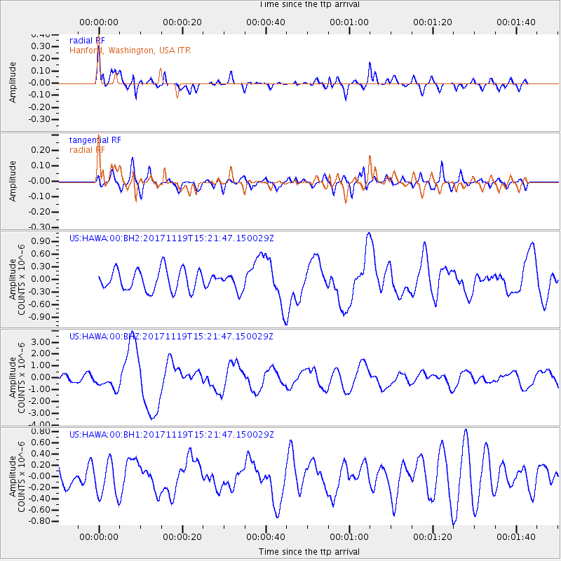
HAWA Hanford, Washington, USA - Earthquake Result Viewer
*The percent match for this event was below the threshold and hence no stack was calculated.
| Earthquake location: |
Loyalty Islands |
| Earthquake latitude/longitude: |
-21.5/168.5 |
| Earthquake time(UTC): |
2017/11/19 (323) 15:09:03 GMT |
| Earthquake Depth: |
14 km |
| Earthquake Magnitude: |
6.6 mww |
| Earthquake Catalog/Contributor: |
NEIC PDE/us |
|
| Network: |
US United States National Seismic Network |
| Station: |
HAWA Hanford, Washington, USA |
| Lat/Lon: |
46.39 N/119.53 W |
| Elevation: |
364 m |
|
| Distance: |
93.6 deg |
| Az: |
41.247 deg |
| Baz: |
242.495 deg |
| Ray Param: |
$rayparam |
*The percent match for this event was below the threshold and hence was not used in the summary stack. |
|
| Radial Match: |
77.231606 % |
| Radial Bump: |
400 |
| Transverse Match: |
59.33337 % |
| Transverse Bump: |
400 |
| SOD ConfigId: |
2429771 |
| Insert Time: |
2017-12-03 15:10:58.531 +0000 |
| GWidth: |
2.5 |
| Max Bumps: |
400 |
| Tol: |
0.001 |
|
Signal To Noise
| Channel | StoN | STA | LTA |
| US:HAWA:00:BHZ:20171119T15:21:47.150029Z | 1.8446966 | 6.512747E-7 | 3.5305249E-7 |
| US:HAWA:00:BH1:20171119T15:21:47.150029Z | 1.5143214 | 3.0708247E-7 | 2.0278554E-7 |
| US:HAWA:00:BH2:20171119T15:21:47.150029Z | 0.80063164 | 2.0135147E-7 | 2.5149077E-7 |
| Arrivals |
| Ps | |
| PpPs | |
| PsPs/PpSs | |


