You are here: Home > Network List > US - United States National Seismic Network Stations List
> Station MIAR Mount Ida, Arkansas, USA > Earthquake Result Viewer
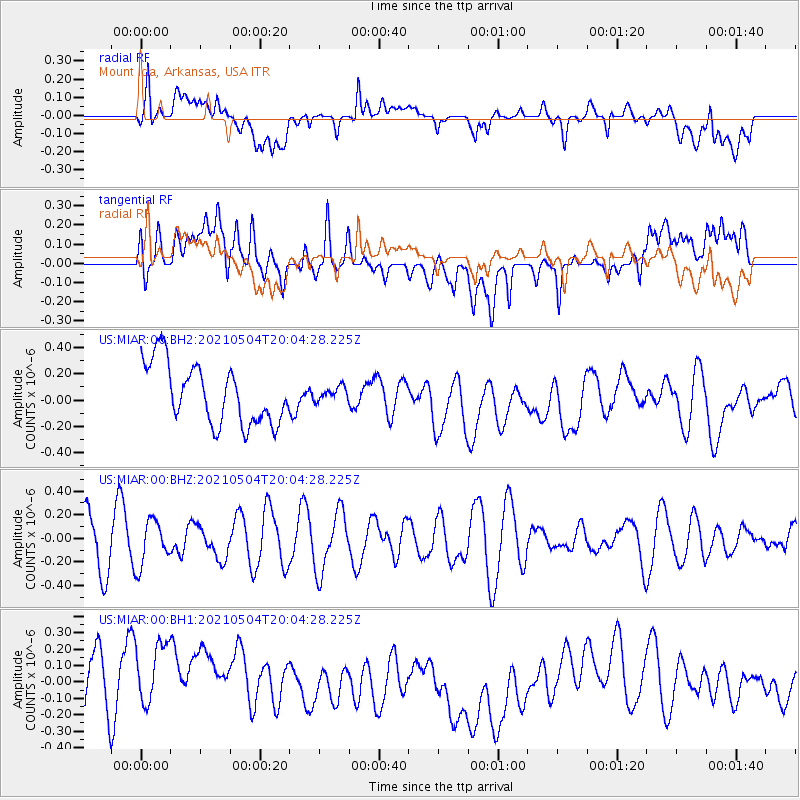
MIAR Mount Ida, Arkansas, USA - Earthquake Result Viewer
*The percent match for this event was below the threshold and hence no stack was calculated.
| Earthquake location: |
Tonga Islands |
| Earthquake latitude/longitude: |
-20.7/-173.8 |
| Earthquake time(UTC): |
2021/05/04 (124) 19:51:42 GMT |
| Earthquake Depth: |
10 km |
| Earthquake Magnitude: |
5.5 mww |
| Earthquake Catalog/Contributor: |
NEIC PDE/us |
|
| Network: |
US United States National Seismic Network |
| Station: |
MIAR Mount Ida, Arkansas, USA |
| Lat/Lon: |
34.55 N/93.58 W |
| Elevation: |
207 m |
|
| Distance: |
93.8 deg |
| Az: |
54.611 deg |
| Baz: |
247.583 deg |
| Ray Param: |
$rayparam |
*The percent match for this event was below the threshold and hence was not used in the summary stack. |
|
| Radial Match: |
47.13754 % |
| Radial Bump: |
400 |
| Transverse Match: |
27.711037 % |
| Transverse Bump: |
400 |
| SOD ConfigId: |
24844331 |
| Insert Time: |
2021-05-18 20:09:50.561 +0000 |
| GWidth: |
2.5 |
| Max Bumps: |
400 |
| Tol: |
0.001 |
|
Signal To Noise
| Channel | StoN | STA | LTA |
| US:MIAR:00:BHZ:20210504T20:04:28.225Z | 0.90991646 | 1.877436E-7 | 2.0633058E-7 |
| US:MIAR:00:BH1:20210504T20:04:28.225Z | 1.4327328 | 3.367816E-7 | 2.3506239E-7 |
| US:MIAR:00:BH2:20210504T20:04:28.225Z | 0.23347133 | 5.2895466E-8 | 2.2656087E-7 |
| Arrivals |
| Ps | |
| PpPs | |
| PsPs/PpSs | |


