You are here: Home > Network List > US - United States National Seismic Network Stations List
> Station MNTX Cornudas Mountains, Texas, USA > Earthquake Result Viewer
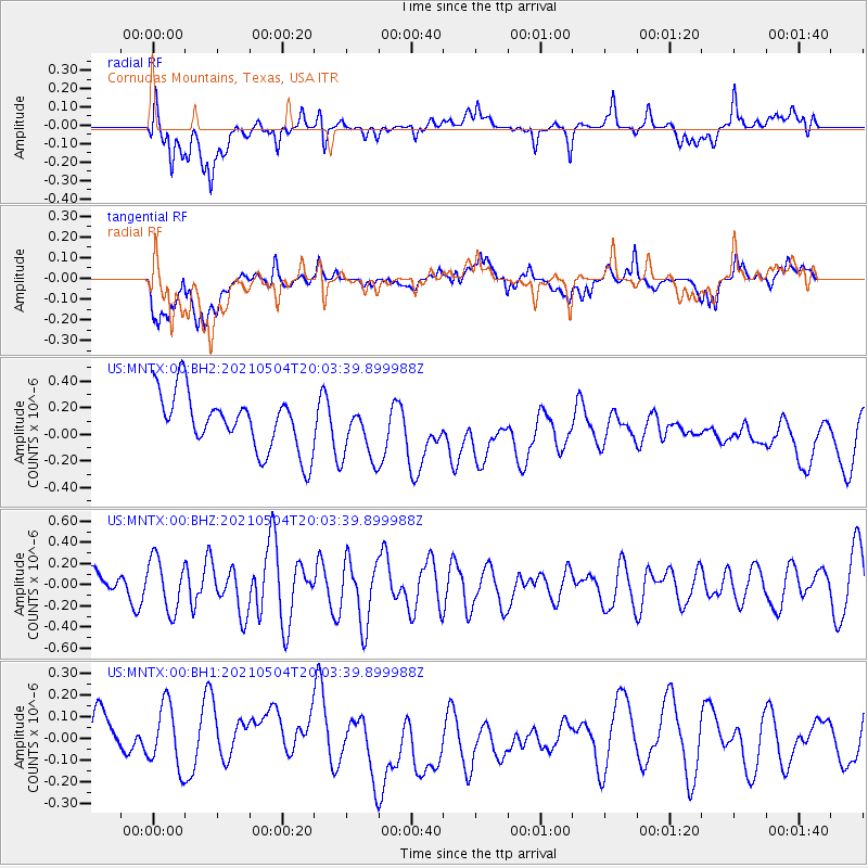
MNTX Cornudas Mountains, Texas, USA - Earthquake Result Viewer
*The percent match for this event was below the threshold and hence no stack was calculated.
| Earthquake location: |
Tonga Islands |
| Earthquake latitude/longitude: |
-20.7/-173.8 |
| Earthquake time(UTC): |
2021/05/04 (124) 19:51:42 GMT |
| Earthquake Depth: |
10 km |
| Earthquake Magnitude: |
5.5 mww |
| Earthquake Catalog/Contributor: |
NEIC PDE/us |
|
| Network: |
US United States National Seismic Network |
| Station: |
MNTX Cornudas Mountains, Texas, USA |
| Lat/Lon: |
31.70 N/105.38 W |
| Elevation: |
404 m |
|
| Distance: |
83.7 deg |
| Az: |
52.874 deg |
| Baz: |
241.107 deg |
| Ray Param: |
$rayparam |
*The percent match for this event was below the threshold and hence was not used in the summary stack. |
|
| Radial Match: |
45.16942 % |
| Radial Bump: |
400 |
| Transverse Match: |
47.68529 % |
| Transverse Bump: |
400 |
| SOD ConfigId: |
24844331 |
| Insert Time: |
2021-05-18 20:09:50.914 +0000 |
| GWidth: |
2.5 |
| Max Bumps: |
400 |
| Tol: |
0.001 |
|
Signal To Noise
| Channel | StoN | STA | LTA |
| US:MNTX:00:BHZ:20210504T20:03:39.899988Z | 1.2420474 | 2.4831067E-7 | 1.9992045E-7 |
| US:MNTX:00:BH1:20210504T20:03:39.899988Z | 1.24846 | 1.6183554E-7 | 1.2962813E-7 |
| US:MNTX:00:BH2:20210504T20:03:39.899988Z | 1.0283835 | 2.1547855E-7 | 2.0953132E-7 |
| Arrivals |
| Ps | |
| PpPs | |
| PsPs/PpSs | |


