You are here: Home > Network List > US - United States National Seismic Network Stations List
> Station MNTX Cornudas Mountains, Texas, USA > Earthquake Result Viewer
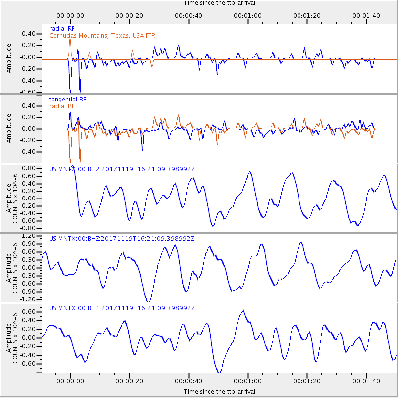
MNTX Cornudas Mountains, Texas, USA - Earthquake Result Viewer
*The percent match for this event was below the threshold and hence no stack was calculated.
| Earthquake location: |
Loyalty Islands |
| Earthquake latitude/longitude: |
-21.2/168.5 |
| Earthquake time(UTC): |
2017/11/19 (323) 16:08:06 GMT |
| Earthquake Depth: |
10 km |
| Earthquake Magnitude: |
5.9 Mww |
| Earthquake Catalog/Contributor: |
NEIC PDE/us |
|
| Network: |
US United States National Seismic Network |
| Station: |
MNTX Cornudas Mountains, Texas, USA |
| Lat/Lon: |
31.70 N/105.38 W |
| Elevation: |
404 m |
|
| Distance: |
97.7 deg |
| Az: |
59.101 deg |
| Baz: |
249.937 deg |
| Ray Param: |
$rayparam |
*The percent match for this event was below the threshold and hence was not used in the summary stack. |
|
| Radial Match: |
76.09263 % |
| Radial Bump: |
400 |
| Transverse Match: |
62.46024 % |
| Transverse Bump: |
400 |
| SOD ConfigId: |
2429771 |
| Insert Time: |
2017-12-03 16:09:20.196 +0000 |
| GWidth: |
2.5 |
| Max Bumps: |
400 |
| Tol: |
0.001 |
|
Signal To Noise
| Channel | StoN | STA | LTA |
| US:MNTX:00:BHZ:20171119T16:21:09.398992Z | 0.6188655 | 2.4970757E-7 | 4.0349246E-7 |
| US:MNTX:00:BH1:20171119T16:21:09.398992Z | 1.4829563 | 3.542889E-7 | 2.3890718E-7 |
| US:MNTX:00:BH2:20171119T16:21:09.398992Z | 0.41368532 | 1.4910187E-7 | 3.604234E-7 |
| Arrivals |
| Ps | |
| PpPs | |
| PsPs/PpSs | |


