You are here: Home > Network List > IU - Global Seismograph Network (GSN - IRIS/USGS) Stations List
> Station POHA Pohakuloa, Hawaii, USA > Earthquake Result Viewer
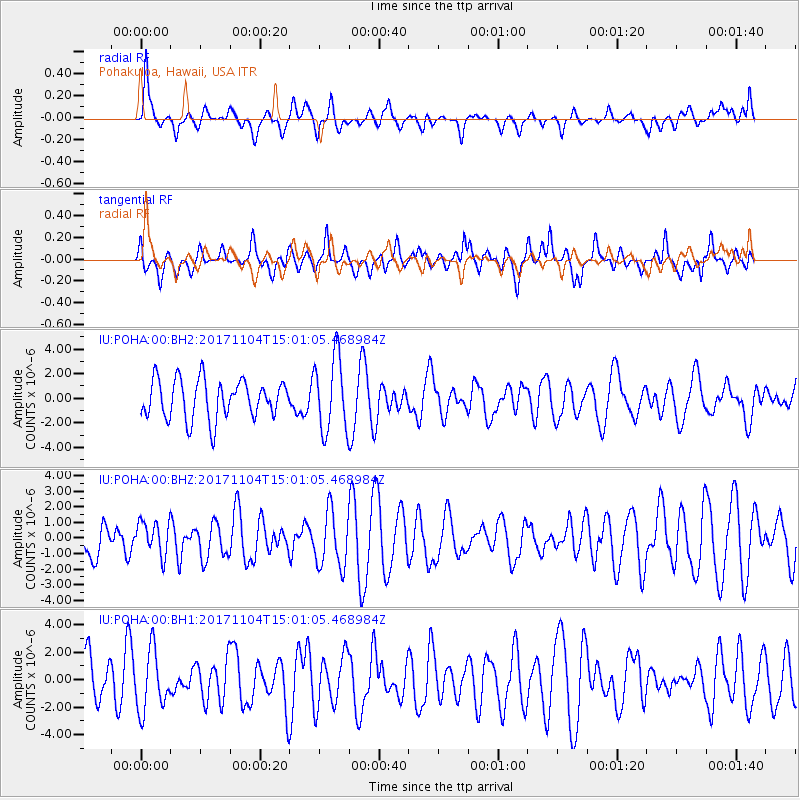
POHA Pohakuloa, Hawaii, USA - Earthquake Result Viewer
*The percent match for this event was below the threshold and hence no stack was calculated.
| Earthquake location: |
Southeast Of Loyalty Islands |
| Earthquake latitude/longitude: |
-21.7/169.1 |
| Earthquake time(UTC): |
2017/11/04 (308) 14:52:14 GMT |
| Earthquake Depth: |
10 km |
| Earthquake Magnitude: |
5.4 Mww |
| Earthquake Catalog/Contributor: |
NEIC PDE/us |
|
| Network: |
IU Global Seismograph Network (GSN - IRIS/USGS) |
| Station: |
POHA Pohakuloa, Hawaii, USA |
| Lat/Lon: |
19.76 N/155.53 W |
| Elevation: |
1990 m |
|
| Distance: |
53.8 deg |
| Az: |
42.496 deg |
| Baz: |
221.843 deg |
| Ray Param: |
$rayparam |
*The percent match for this event was below the threshold and hence was not used in the summary stack. |
|
| Radial Match: |
46.488914 % |
| Radial Bump: |
400 |
| Transverse Match: |
52.053375 % |
| Transverse Bump: |
370 |
| SOD ConfigId: |
2429771 |
| Insert Time: |
2017-12-03 18:55:50.352 +0000 |
| GWidth: |
2.5 |
| Max Bumps: |
400 |
| Tol: |
0.001 |
|
Signal To Noise
| Channel | StoN | STA | LTA |
| IU:POHA:00:BHZ:20171104T15:01:05.468984Z | 0.8111182 | 1.0989891E-6 | 1.3549062E-6 |
| IU:POHA:00:BH1:20171104T15:01:05.468984Z | 1.3877944 | 2.195423E-6 | 1.5819511E-6 |
| IU:POHA:00:BH2:20171104T15:01:05.468984Z | 1.9407569 | 3.0658307E-6 | 1.5797087E-6 |
| Arrivals |
| Ps | |
| PpPs | |
| PsPs/PpSs | |


