You are here: Home > Network List > US - United States National Seismic Network Stations List
> Station HDIL Hopedale, Illinois, USA > Earthquake Result Viewer
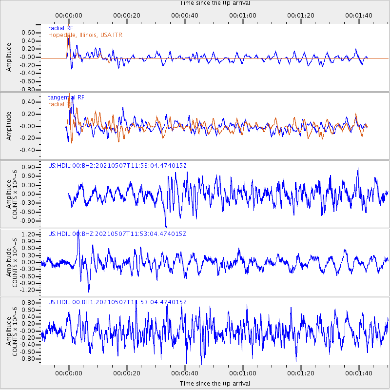
HDIL Hopedale, Illinois, USA - Earthquake Result Viewer
*The percent match for this event was below the threshold and hence no stack was calculated.
| Earthquake location: |
North Atlantic Ocean |
| Earthquake latitude/longitude: |
14.1/-48.4 |
| Earthquake time(UTC): |
2021/05/07 (127) 11:45:25 GMT |
| Earthquake Depth: |
10 km |
| Earthquake Magnitude: |
5.5 mww |
| Earthquake Catalog/Contributor: |
NEIC PDE/us |
|
| Network: |
US United States National Seismic Network |
| Station: |
HDIL Hopedale, Illinois, USA |
| Lat/Lon: |
40.56 N/89.29 W |
| Elevation: |
219 m |
|
| Distance: |
44.3 deg |
| Az: |
314.441 deg |
| Baz: |
114.602 deg |
| Ray Param: |
$rayparam |
*The percent match for this event was below the threshold and hence was not used in the summary stack. |
|
| Radial Match: |
54.275547 % |
| Radial Bump: |
400 |
| Transverse Match: |
74.18693 % |
| Transverse Bump: |
400 |
| SOD ConfigId: |
24844331 |
| Insert Time: |
2021-05-21 12:10:53.087 +0000 |
| GWidth: |
2.5 |
| Max Bumps: |
400 |
| Tol: |
0.001 |
|
Signal To Noise
| Channel | StoN | STA | LTA |
| US:HDIL:00:BHZ:20210507T11:53:04.474015Z | 2.1218343 | 4.4884558E-7 | 2.1153659E-7 |
| US:HDIL:00:BH1:20210507T11:53:04.474015Z | 1.784179 | 2.942772E-7 | 1.6493703E-7 |
| US:HDIL:00:BH2:20210507T11:53:04.474015Z | 2.200638 | 4.2457225E-7 | 1.9293144E-7 |
| Arrivals |
| Ps | |
| PpPs | |
| PsPs/PpSs | |


