You are here: Home > Network List > WY - Yellowstone Wyoming Seismic Network Stations List
> Station YHH Holmes Hill, YNP, WY, USA > Earthquake Result Viewer
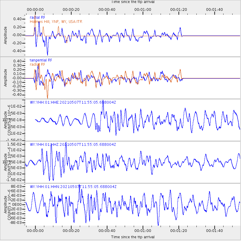
YHH Holmes Hill, YNP, WY, USA - Earthquake Result Viewer
*The percent match for this event was below the threshold and hence no stack was calculated.
| Earthquake location: |
North Atlantic Ocean |
| Earthquake latitude/longitude: |
14.1/-48.4 |
| Earthquake time(UTC): |
2021/05/07 (127) 11:45:25 GMT |
| Earthquake Depth: |
10 km |
| Earthquake Magnitude: |
5.5 mww |
| Earthquake Catalog/Contributor: |
NEIC PDE/us |
|
| Network: |
WY Yellowstone Wyoming Seismic Network |
| Station: |
YHH Holmes Hill, YNP, WY, USA |
| Lat/Lon: |
44.79 N/110.85 W |
| Elevation: |
2717 m |
|
| Distance: |
60.7 deg |
| Az: |
313.618 deg |
| Baz: |
99.434 deg |
| Ray Param: |
$rayparam |
*The percent match for this event was below the threshold and hence was not used in the summary stack. |
|
| Radial Match: |
61.340675 % |
| Radial Bump: |
352 |
| Transverse Match: |
59.359043 % |
| Transverse Bump: |
384 |
| SOD ConfigId: |
24844331 |
| Insert Time: |
2021-05-21 12:12:58.169 +0000 |
| GWidth: |
2.5 |
| Max Bumps: |
400 |
| Tol: |
0.001 |
|
Signal To Noise
| Channel | StoN | STA | LTA |
| WY:YHH:01:HHZ:20210507T11:55:05.688004Z | 1.7688856 | 4.3812776E-9 | 2.4768574E-9 |
| WY:YHH:01:HHN:20210507T11:55:05.688004Z | 1.2486142 | 3.1375702E-9 | 2.512842E-9 |
| WY:YHH:01:HHE:20210507T11:55:05.688004Z | 2.2642462 | 3.9905332E-9 | 1.7624112E-9 |
| Arrivals |
| Ps | |
| PpPs | |
| PsPs/PpSs | |


