
KHA XW.KHA - Earthquake Result Viewer
| ||||||||||||||||||
| ||||||||||||||||||
| ||||||||||||||||||
|
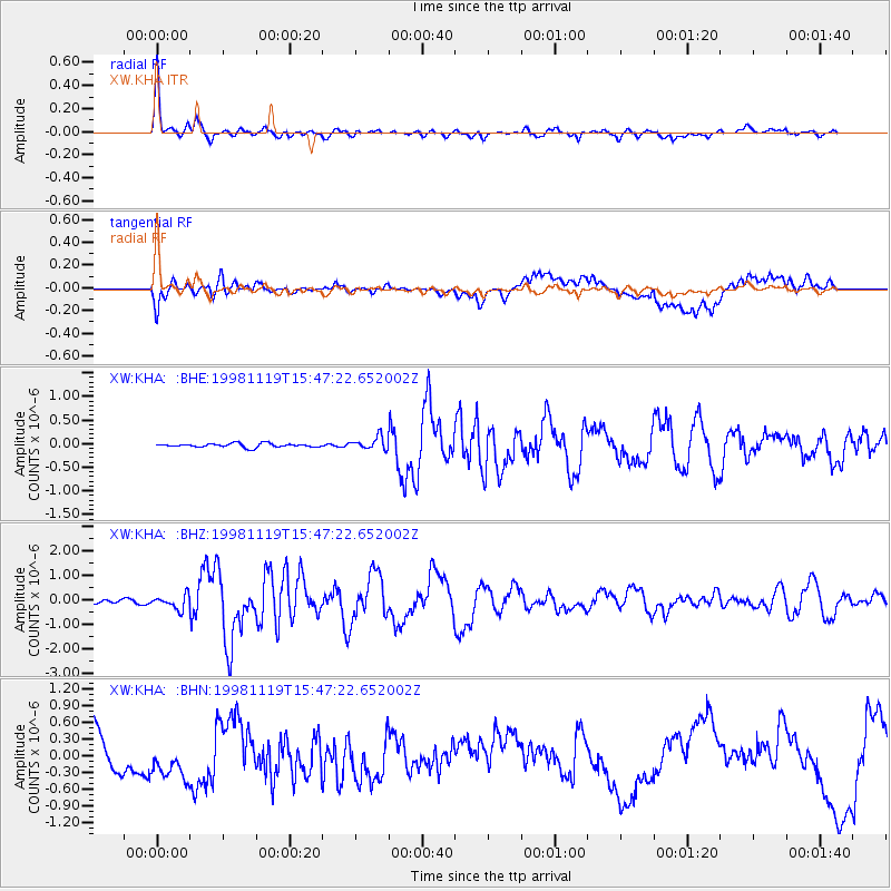
Signal To Noise
| Channel | StoN | STA | LTA |
| XW:KHA: :BHZ:19981119T15:47:22.652002Z | 5.7098665 | 2.835584E-7 | 4.9661125E-8 |
| XW:KHA: :BHN:19981119T15:47:22.652002Z | 0.6733839 | 3.5810248E-7 | 5.317954E-7 |
| XW:KHA: :BHE:19981119T15:47:22.652002Z | 3.435233 | 1.3641973E-7 | 3.9711928E-8 |
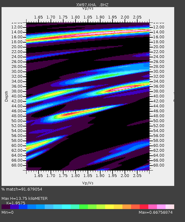
| Arrivals | |
| Ps | 2.2 SECOND |
| PpPs | 6.1 SECOND |
| PsPs/PpSs | 8.3 SECOND |

