You are here: Home > Network List > GS - US Geological Survey Networks Stations List
> Station OK051 E0350 and S34600 roads, Ralston OK > Earthquake Result Viewer
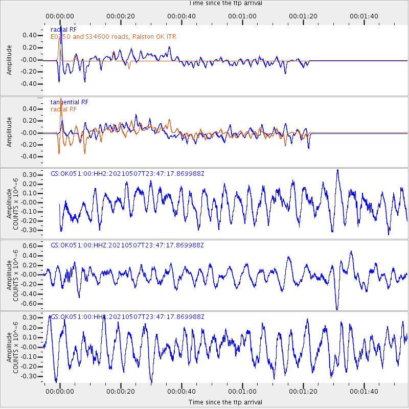
OK051 E0350 and S34600 roads, Ralston OK - Earthquake Result Viewer
*The percent match for this event was below the threshold and hence no stack was calculated.
| Earthquake location: |
Fiji Islands Region |
| Earthquake latitude/longitude: |
-18.8/-177.5 |
| Earthquake time(UTC): |
2021/05/07 (127) 23:35:14 GMT |
| Earthquake Depth: |
384 km |
| Earthquake Magnitude: |
6.1 Mww |
| Earthquake Catalog/Contributor: |
NEIC PDE/us |
|
| Network: |
GS US Geological Survey Networks |
| Station: |
OK051 E0350 and S34600 roads, Ralston OK |
| Lat/Lon: |
36.50 N/96.84 W |
| Elevation: |
263 m |
|
| Distance: |
93.8 deg |
| Az: |
52.82 deg |
| Baz: |
249.504 deg |
| Ray Param: |
$rayparam |
*The percent match for this event was below the threshold and hence was not used in the summary stack. |
|
| Radial Match: |
51.542507 % |
| Radial Bump: |
400 |
| Transverse Match: |
49.565327 % |
| Transverse Bump: |
400 |
| SOD ConfigId: |
24844331 |
| Insert Time: |
2021-05-21 23:51:31.558 +0000 |
| GWidth: |
2.5 |
| Max Bumps: |
400 |
| Tol: |
0.001 |
|
Signal To Noise
| Channel | StoN | STA | LTA |
| GS:OK051:00:HHZ:20210507T23:47:17.869988Z | 1.3341887 | 1.4306781E-7 | 1.0723207E-7 |
| GS:OK051:00:HH1:20210507T23:47:17.869988Z | 1.5100238 | 1.658911E-7 | 1.09859926E-7 |
| GS:OK051:00:HH2:20210507T23:47:17.869988Z | 1.3626593 | 1.522308E-7 | 1.1171596E-7 |
| Arrivals |
| Ps | |
| PpPs | |
| PsPs/PpSs | |


