You are here: Home > Network List > US - United States National Seismic Network Stations List
> Station HAWA Hanford, Washington, USA > Earthquake Result Viewer
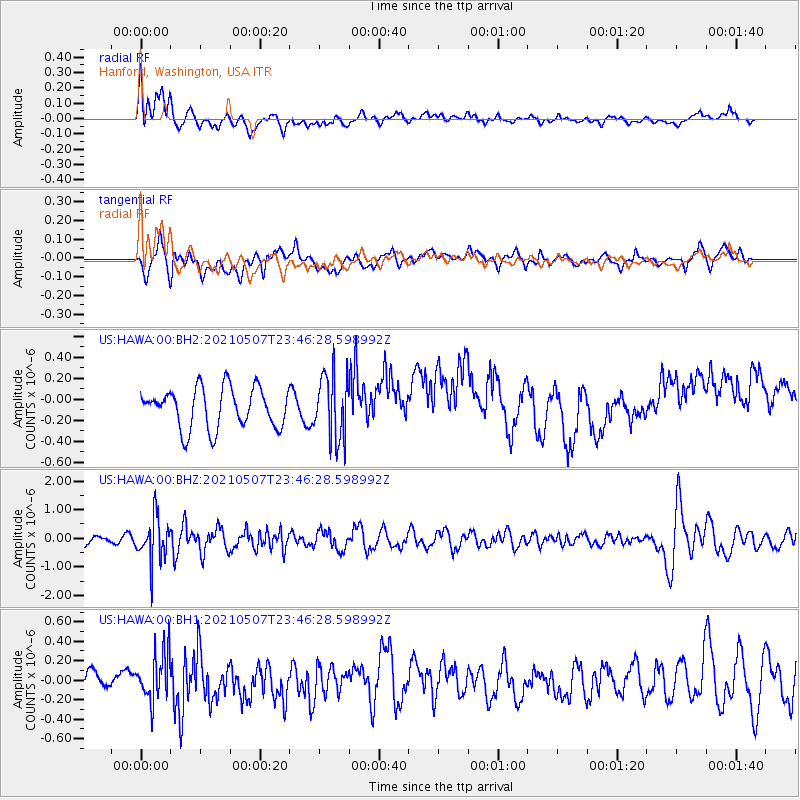
HAWA Hanford, Washington, USA - Earthquake Result Viewer
*The percent match for this event was below the threshold and hence no stack was calculated.
| Earthquake location: |
Fiji Islands Region |
| Earthquake latitude/longitude: |
-18.8/-177.5 |
| Earthquake time(UTC): |
2021/05/07 (127) 23:35:14 GMT |
| Earthquake Depth: |
384 km |
| Earthquake Magnitude: |
6.1 Mww |
| Earthquake Catalog/Contributor: |
NEIC PDE/us |
|
| Network: |
US United States National Seismic Network |
| Station: |
HAWA Hanford, Washington, USA |
| Lat/Lon: |
46.39 N/119.53 W |
| Elevation: |
364 m |
|
| Distance: |
83.3 deg |
| Az: |
36.207 deg |
| Baz: |
233.942 deg |
| Ray Param: |
$rayparam |
*The percent match for this event was below the threshold and hence was not used in the summary stack. |
|
| Radial Match: |
51.509563 % |
| Radial Bump: |
400 |
| Transverse Match: |
44.158577 % |
| Transverse Bump: |
400 |
| SOD ConfigId: |
24844331 |
| Insert Time: |
2021-05-21 23:59:59.237 +0000 |
| GWidth: |
2.5 |
| Max Bumps: |
400 |
| Tol: |
0.001 |
|
Signal To Noise
| Channel | StoN | STA | LTA |
| US:HAWA:00:BHZ:20210507T23:46:28.598992Z | 4.774277 | 7.7040573E-7 | 1.6136595E-7 |
| US:HAWA:00:BH1:20210507T23:46:28.598992Z | 1.6478436 | 2.4314787E-7 | 1.4755518E-7 |
| US:HAWA:00:BH2:20210507T23:46:28.598992Z | 1.6303128 | 3.0948326E-7 | 1.898306E-7 |
| Arrivals |
| Ps | |
| PpPs | |
| PsPs/PpSs | |


