You are here: Home > Network List > UW - Pacific Northwest Regional Seismic Network Stations List
> Station HOOD Mt Hood Meadows, OR CREST BB SMO > Earthquake Result Viewer
HOOD Mt Hood Meadows, OR CREST BB SMO - Earthquake Result Viewer
*The percent match for this event was below the threshold and hence no stack was calculated.
| Earthquake location: |
Fiji Islands Region |
| Earthquake latitude/longitude: |
-18.8/-177.5 |
| Earthquake time(UTC): |
2021/05/07 (127) 23:35:14 GMT |
| Earthquake Depth: |
384 km |
| Earthquake Magnitude: |
6.1 Mww |
| Earthquake Catalog/Contributor: |
NEIC PDE/us |
|
| Network: |
UW Pacific Northwest Regional Seismic Network |
| Station: |
HOOD Mt Hood Meadows, OR CREST BB SMO |
| Lat/Lon: |
45.32 N/121.65 W |
| Elevation: |
1520 m |
|
| Distance: |
81.5 deg |
| Az: |
36.176 deg |
| Baz: |
232.42 deg |
| Ray Param: |
$rayparam |
*The percent match for this event was below the threshold and hence was not used in the summary stack. |
|
| Radial Match: |
53.970913 % |
| Radial Bump: |
400 |
| Transverse Match: |
44.289207 % |
| Transverse Bump: |
400 |
| SOD ConfigId: |
24844331 |
| Insert Time: |
2021-05-22 00:01:07.798 +0000 |
| GWidth: |
2.5 |
| Max Bumps: |
400 |
| Tol: |
0.001 |
|
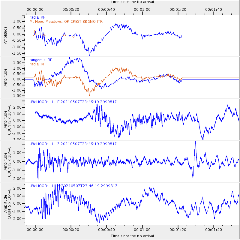
Signal To Noise
| Channel | StoN | STA | LTA |
| UW:HOOD: :HHZ:20210507T23:46:19.299981Z | 5.975762 | 7.555853E-7 | 1.2644166E-7 |
| UW:HOOD: :HHN:20210507T23:46:19.299981Z | 2.0058973 | 8.143789E-7 | 4.0599235E-7 |
| UW:HOOD: :HHE:20210507T23:46:19.299981Z | 1.9802628 | 9.0412294E-7 | 4.5656716E-7 |
| Arrivals |
| Ps | |
| PpPs | |
| PsPs/PpSs | |


