You are here: Home > Network List > II - Global Seismograph Network (GSN - IRIS/IDA) Stations List
> Station WRAB Tennant Creek, NT, Australia > Earthquake Result Viewer
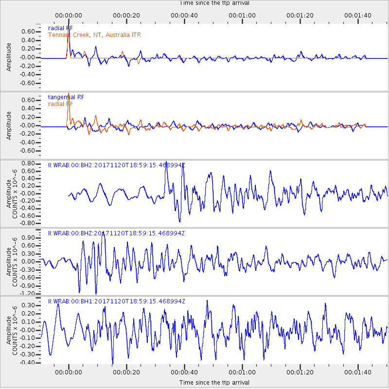
WRAB Tennant Creek, NT, Australia - Earthquake Result Viewer
*The percent match for this event was below the threshold and hence no stack was calculated.
| Earthquake location: |
Samoa Islands Region |
| Earthquake latitude/longitude: |
-14.4/-175.1 |
| Earthquake time(UTC): |
2017/11/20 (324) 18:51:04 GMT |
| Earthquake Depth: |
10 km |
| Earthquake Magnitude: |
6.2 Mi |
| Earthquake Catalog/Contributor: |
NEIC PDE/pt |
|
| Network: |
II Global Seismograph Network (GSN - IRIS/IDA) |
| Station: |
WRAB Tennant Creek, NT, Australia |
| Lat/Lon: |
19.93 S/134.36 E |
| Elevation: |
366 m |
|
| Distance: |
48.4 deg |
| Az: |
256.002 deg |
| Baz: |
91.759 deg |
| Ray Param: |
$rayparam |
*The percent match for this event was below the threshold and hence was not used in the summary stack. |
|
| Radial Match: |
79.4311 % |
| Radial Bump: |
400 |
| Transverse Match: |
71.40853 % |
| Transverse Bump: |
400 |
| SOD ConfigId: |
2429771 |
| Insert Time: |
2017-12-04 18:52:58.515 +0000 |
| GWidth: |
2.5 |
| Max Bumps: |
400 |
| Tol: |
0.001 |
|
Signal To Noise
| Channel | StoN | STA | LTA |
| II:WRAB:00:BHZ:20171120T18:59:15.468994Z | 2.2611089 | 3.8558758E-7 | 1.705303E-7 |
| II:WRAB:00:BH1:20171120T18:59:15.468994Z | 0.7362069 | 1.2591862E-7 | 1.71037E-7 |
| II:WRAB:00:BH2:20171120T18:59:15.468994Z | 2.5229871 | 3.203495E-7 | 1.269723E-7 |
| Arrivals |
| Ps | |
| PpPs | |
| PsPs/PpSs | |


