KHA XW.KHA - Earthquake Result Viewer
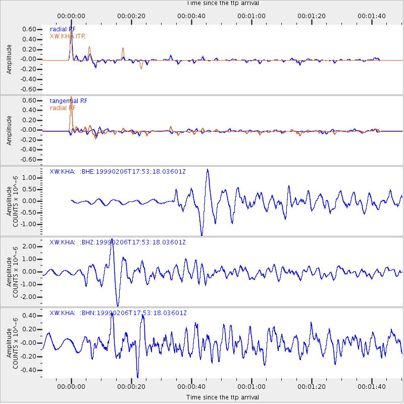
Earthquake location: Philippine Islands Region
Earthquake latitude/longitude: 19.2/121.3
Earthquake time(UTC): 1999/02/06 (037) 17:45:24 GMT
Earthquake Depth: 33 km
Earthquake Magnitude: 5.6 MS, 5.4 MB, 6.0 MW, 5.9 MW
Earthquake Catalog/Contributor: WHDF/NEIC
Network: XW Tien Shan Continental Dynamics
Station: KHA XW.KHA
Lat/Lon: 44.21 N/74.00 E
Elevation: 1014 m
Distance: 46.5 deg
Az: 313.264 deg
Baz: 106.87 deg
Ray Param: 0.070541926
Estimated Moho Depth: 16.5 km
Estimated Crust Vp/Vs: 1.66
Assumed Crust Vp: 6.35 km/s
Estimated Crust Vs: 3.831 km/s
Estimated Crust Poisson's Ratio: 0.21
Radial Match: 93.318924 %
Radial Bump: 197
Transverse Match: 67.516396 %
Transverse Bump: 400
SOD ConfigId: 4480
Insert Time: 2010-02-26 15:34:40.716 +0000
GWidth: 2.5
Max Bumps: 400
Tol: 0.001

Signal To Noise

ChannelStoNSTALTA
XW:KHA: :BHZ:19990206T17:53:18.03601Z2.53711772.7427217E-71.0810384E-7
XW:KHA: :BHN:19990206T17:53:18.03601Z0.75256448.145472E-81.0823622E-7
XW:KHA: :BHE:19990206T17:53:18.03601Z1.62770881.1359795E-76.979009E-8
Arrivals
Ps1.8 SECOND
PpPs6.5 SECOND
PsPs/PpSs8.3 SECOND