
KHA XW.KHA - Earthquake Result Viewer
| ||||||||||||||||||
| ||||||||||||||||||
| ||||||||||||||||||
|
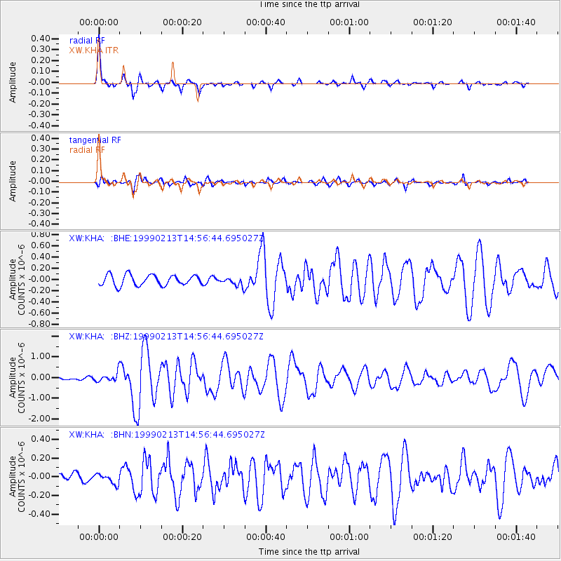
Signal To Noise
| Channel | StoN | STA | LTA |
| XW:KHA: :BHZ:19990213T14:56:44.695027Z | 3.8808692 | 2.323467E-7 | 5.9869755E-8 |
| XW:KHA: :BHN:19990213T14:56:44.695027Z | 0.745855 | 5.5023925E-8 | 7.377296E-8 |
| XW:KHA: :BHE:19990213T14:56:44.695027Z | 0.8424031 | 7.903584E-8 | 9.382188E-8 |
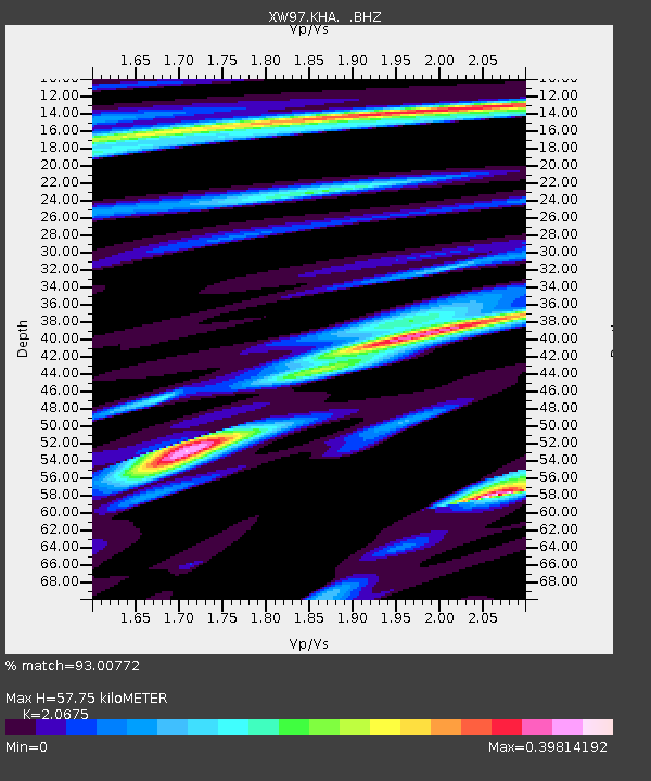
| Arrivals | |
| Ps | 9.9 SECOND |
| PpPs | 27 SECOND |
| PsPs/PpSs | 37 SECOND |

