
KHA XW.KHA - Earthquake Result Viewer
| ||||||||||||||||||
| ||||||||||||||||||
| ||||||||||||||||||
|
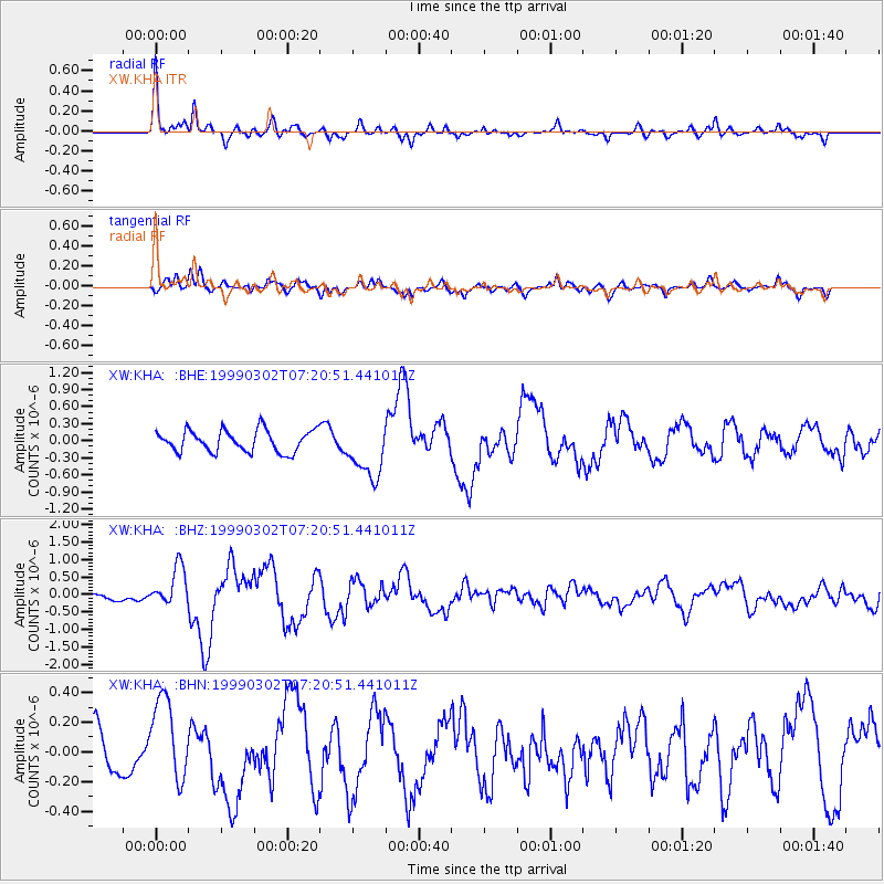
Signal To Noise
| Channel | StoN | STA | LTA |
| XW:KHA: :BHZ:19990302T07:20:51.441011Z | 6.222712 | 5.5579363E-7 | 8.931695E-8 |
| XW:KHA: :BHN:19990302T07:20:51.441011Z | 1.8105388 | 2.899626E-7 | 1.6015265E-7 |
| XW:KHA: :BHE:19990302T07:20:51.441011Z | 2.6424615 | 4.95914E-7 | 1.8767122E-7 |
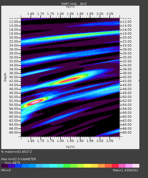
| Arrivals | |
| Ps | 5.9 SECOND |
| PpPs | 21 SECOND |
| PsPs/PpSs | 27 SECOND |

