You are here: Home > Network List > AV - Alaska Volcano Observatory Stations List
> Station MAPS Pakushin Southeast, Makushin Volcano, Alaska > Earthquake Result Viewer
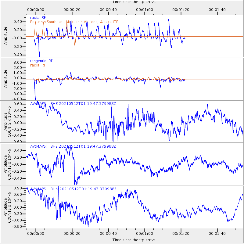
MAPS Pakushin Southeast, Makushin Volcano, Alaska - Earthquake Result Viewer
*The percent match for this event was below the threshold and hence no stack was calculated.
| Earthquake location: |
Mindoro, Philippines |
| Earthquake latitude/longitude: |
13.6/120.8 |
| Earthquake time(UTC): |
2021/05/12 (132) 01:09:27 GMT |
| Earthquake Depth: |
113 km |
| Earthquake Magnitude: |
5.8 mww |
| Earthquake Catalog/Contributor: |
NEIC PDE/us |
|
| Network: |
AV Alaska Volcano Observatory |
| Station: |
MAPS Pakushin Southeast, Makushin Volcano, Alaska |
| Lat/Lon: |
53.81 N/166.94 W |
| Elevation: |
333 m |
|
| Distance: |
68.7 deg |
| Az: |
37.322 deg |
| Baz: |
263.781 deg |
| Ray Param: |
$rayparam |
*The percent match for this event was below the threshold and hence was not used in the summary stack. |
|
| Radial Match: |
81.25952 % |
| Radial Bump: |
400 |
| Transverse Match: |
61.80474 % |
| Transverse Bump: |
285 |
| SOD ConfigId: |
24890451 |
| Insert Time: |
2021-06-02 14:05:09.865 +0000 |
| GWidth: |
2.5 |
| Max Bumps: |
400 |
| Tol: |
0.001 |
|
Signal To Noise
| Channel | StoN | STA | LTA |
| AV:MAPS: :BHZ:20210512T01:19:47.379988Z | 1.2259371 | 2.164435E-7 | 1.765535E-7 |
| AV:MAPS: :BHN:20210512T01:19:47.379988Z | 1.0868376 | 1.7561897E-6 | 1.6158713E-6 |
| AV:MAPS: :BHE:20210512T01:19:47.379988Z | 1.3753301 | 4.2160354E-7 | 3.0654715E-7 |
| Arrivals |
| Ps | |
| PpPs | |
| PsPs/PpSs | |


