You are here: Home > Network List > US - United States National Seismic Network Stations List
> Station EGMT Eagleton, Montana, USA > Earthquake Result Viewer
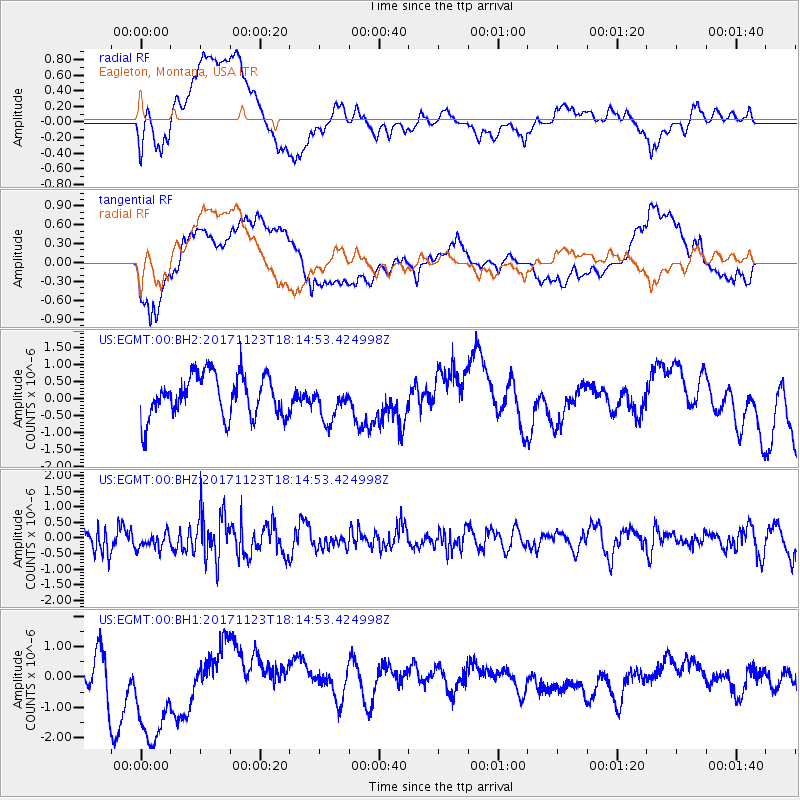
EGMT Eagleton, Montana, USA - Earthquake Result Viewer
*The percent match for this event was below the threshold and hence no stack was calculated.
| Earthquake location: |
Ryukyu Islands, Japan |
| Earthquake latitude/longitude: |
27.1/130.4 |
| Earthquake time(UTC): |
2017/11/23 (327) 18:02:35 GMT |
| Earthquake Depth: |
10 km |
| Earthquake Magnitude: |
5.5 Mww |
| Earthquake Catalog/Contributor: |
NEIC PDE/us |
|
| Network: |
US United States National Seismic Network |
| Station: |
EGMT Eagleton, Montana, USA |
| Lat/Lon: |
48.02 N/109.75 W |
| Elevation: |
1055 m |
|
| Distance: |
87.8 deg |
| Az: |
35.63 deg |
| Baz: |
309.35 deg |
| Ray Param: |
$rayparam |
*The percent match for this event was below the threshold and hence was not used in the summary stack. |
|
| Radial Match: |
56.721207 % |
| Radial Bump: |
400 |
| Transverse Match: |
50.800846 % |
| Transverse Bump: |
400 |
| SOD ConfigId: |
2429771 |
| Insert Time: |
2017-12-07 18:04:38.269 +0000 |
| GWidth: |
2.5 |
| Max Bumps: |
400 |
| Tol: |
0.001 |
|
Signal To Noise
| Channel | StoN | STA | LTA |
| US:EGMT:00:BHZ:20171123T18:14:53.424998Z | 0.6485454 | 2.478078E-7 | 3.8209785E-7 |
| US:EGMT:00:BH1:20171123T18:14:53.424998Z | 2.2928047 | 2.1023975E-6 | 9.1695443E-7 |
| US:EGMT:00:BH2:20171123T18:14:53.424998Z | 0.8638193 | 5.347249E-7 | 6.1902404E-7 |
| Arrivals |
| Ps | |
| PpPs | |
| PsPs/PpSs | |


