You are here: Home > Network List > AV - Alaska Volcano Observatory Stations List
> Station MAPS Pakushin Southeast, Makushin Volcano, Alaska > Earthquake Result Viewer
MAPS Pakushin Southeast, Makushin Volcano, Alaska - Earthquake Result Viewer
*The percent match for this event was below the threshold and hence no stack was calculated.
| Earthquake location: |
Near Coast Of Guatemala |
| Earthquake latitude/longitude: |
13.3/-90.3 |
| Earthquake time(UTC): |
2021/05/12 (132) 06:17:09 GMT |
| Earthquake Depth: |
51 km |
| Earthquake Magnitude: |
5.6 Mww |
| Earthquake Catalog/Contributor: |
NEIC PDE/us |
|
| Network: |
AV Alaska Volcano Observatory |
| Station: |
MAPS Pakushin Southeast, Makushin Volcano, Alaska |
| Lat/Lon: |
53.81 N/166.94 W |
| Elevation: |
333 m |
|
| Distance: |
71.4 deg |
| Az: |
322.513 deg |
| Baz: |
92.764 deg |
| Ray Param: |
$rayparam |
*The percent match for this event was below the threshold and hence was not used in the summary stack. |
|
| Radial Match: |
99.96887 % |
| Radial Bump: |
8 |
| Transverse Match: |
99.97997 % |
| Transverse Bump: |
7 |
| SOD ConfigId: |
24890451 |
| Insert Time: |
2021-06-02 14:15:05.637 +0000 |
| GWidth: |
2.5 |
| Max Bumps: |
400 |
| Tol: |
0.001 |
|
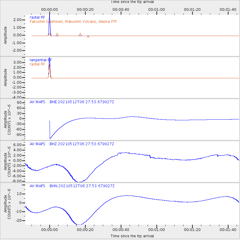
Signal To Noise
| Channel | StoN | STA | LTA |
| AV:MAPS: :BHZ:20210512T06:27:53.679027Z | 0.7825161 | 1.4986363E-5 | 1.9151506E-5 |
| AV:MAPS: :BHN:20210512T06:27:53.679027Z | 0.776748 | 4.4710378E-5 | 5.756098E-5 |
| AV:MAPS: :BHE:20210512T06:27:53.679027Z | 0.79189146 | 2.7324104E-5 | 3.450486E-5 |
| Arrivals |
| Ps | |
| PpPs | |
| PsPs/PpSs | |


