You are here: Home > Network List > CI - Caltech Regional Seismic Network Stations List
> Station SMM Simmler, CA, USA > Earthquake Result Viewer
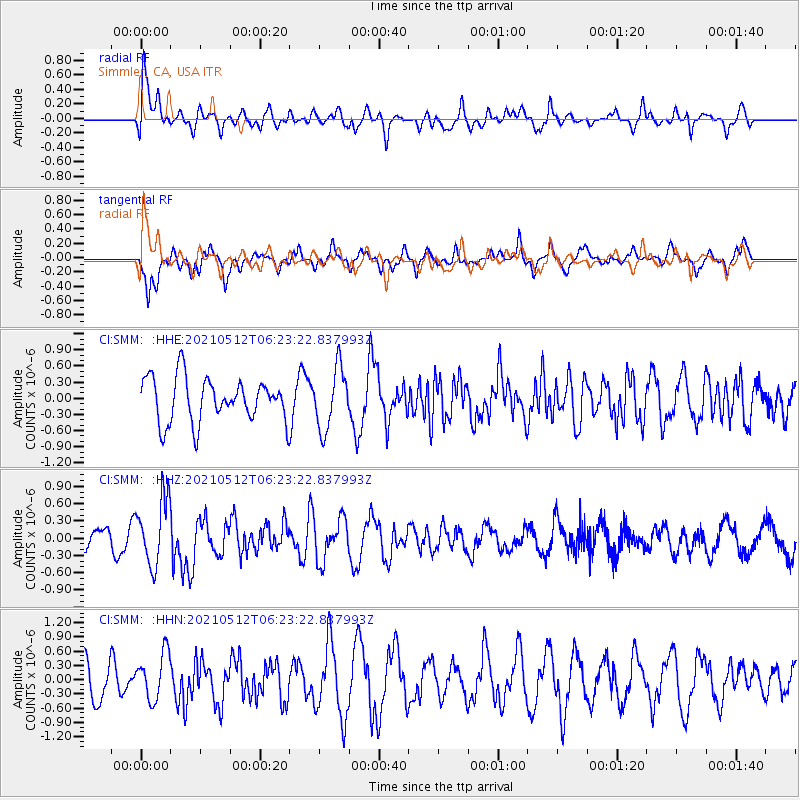
SMM Simmler, CA, USA - Earthquake Result Viewer
*The percent match for this event was below the threshold and hence no stack was calculated.
| Earthquake location: |
Near Coast Of Guatemala |
| Earthquake latitude/longitude: |
13.3/-90.3 |
| Earthquake time(UTC): |
2021/05/12 (132) 06:17:09 GMT |
| Earthquake Depth: |
51 km |
| Earthquake Magnitude: |
5.6 Mww |
| Earthquake Catalog/Contributor: |
NEIC PDE/us |
|
| Network: |
CI Caltech Regional Seismic Network |
| Station: |
SMM Simmler, CA, USA |
| Lat/Lon: |
35.31 N/120.00 W |
| Elevation: |
599 m |
|
| Distance: |
34.5 deg |
| Az: |
314.475 deg |
| Baz: |
121.865 deg |
| Ray Param: |
$rayparam |
*The percent match for this event was below the threshold and hence was not used in the summary stack. |
|
| Radial Match: |
64.829475 % |
| Radial Bump: |
400 |
| Transverse Match: |
65.85661 % |
| Transverse Bump: |
400 |
| SOD ConfigId: |
24890451 |
| Insert Time: |
2021-06-02 14:18:39.339 +0000 |
| GWidth: |
2.5 |
| Max Bumps: |
400 |
| Tol: |
0.001 |
|
Signal To Noise
| Channel | StoN | STA | LTA |
| CI:SMM: :HHZ:20210512T06:23:22.837993Z | 2.3790681 | 5.837628E-7 | 2.4537457E-7 |
| CI:SMM: :HHN:20210512T06:23:22.837993Z | 1.0020497 | 4.927431E-7 | 4.9173514E-7 |
| CI:SMM: :HHE:20210512T06:23:22.837993Z | 1.3861003 | 5.670987E-7 | 4.0913253E-7 |
| Arrivals |
| Ps | |
| PpPs | |
| PsPs/PpSs | |


