You are here: Home > Network List > UW - Pacific Northwest Regional Seismic Network Stations List
> Station HOOD Mt Hood Meadows, OR CREST BB SMO > Earthquake Result Viewer
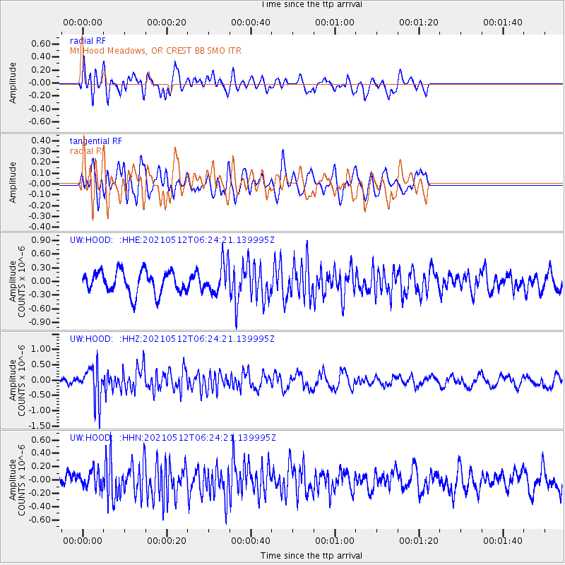
HOOD Mt Hood Meadows, OR CREST BB SMO - Earthquake Result Viewer
*The percent match for this event was below the threshold and hence no stack was calculated.
| Earthquake location: |
Near Coast Of Guatemala |
| Earthquake latitude/longitude: |
13.3/-90.3 |
| Earthquake time(UTC): |
2021/05/12 (132) 06:17:09 GMT |
| Earthquake Depth: |
51 km |
| Earthquake Magnitude: |
5.6 Mww |
| Earthquake Catalog/Contributor: |
NEIC PDE/us |
|
| Network: |
UW Pacific Northwest Regional Seismic Network |
| Station: |
HOOD Mt Hood Meadows, OR CREST BB SMO |
| Lat/Lon: |
45.32 N/121.65 W |
| Elevation: |
1520 m |
|
| Distance: |
41.5 deg |
| Az: |
326.392 deg |
| Baz: |
130.212 deg |
| Ray Param: |
$rayparam |
*The percent match for this event was below the threshold and hence was not used in the summary stack. |
|
| Radial Match: |
70.22277 % |
| Radial Bump: |
400 |
| Transverse Match: |
63.132236 % |
| Transverse Bump: |
400 |
| SOD ConfigId: |
24890451 |
| Insert Time: |
2021-06-02 14:26:12.269 +0000 |
| GWidth: |
2.5 |
| Max Bumps: |
400 |
| Tol: |
0.001 |
|
Signal To Noise
| Channel | StoN | STA | LTA |
| UW:HOOD: :HHZ:20210512T06:24:21.139995Z | 6.117116 | 5.5416075E-7 | 9.059183E-8 |
| UW:HOOD: :HHN:20210512T06:24:21.139995Z | 0.8504114 | 1.317493E-7 | 1.549242E-7 |
| UW:HOOD: :HHE:20210512T06:24:21.139995Z | 1.3417951 | 3.2473454E-7 | 2.42015E-7 |
| Arrivals |
| Ps | |
| PpPs | |
| PsPs/PpSs | |


