You are here: Home > Network List > US - United States National Seismic Network Stations List
> Station MSO Missoula, Montana, USA > Earthquake Result Viewer
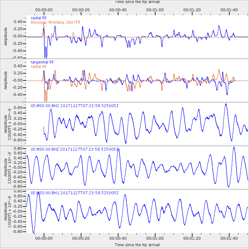
MSO Missoula, Montana, USA - Earthquake Result Viewer
*The percent match for this event was below the threshold and hence no stack was calculated.
| Earthquake location: |
New Ireland Region, P.N.G. |
| Earthquake latitude/longitude: |
-4.6/153.2 |
| Earthquake time(UTC): |
2017/11/27 (331) 07:11:12 GMT |
| Earthquake Depth: |
58 km |
| Earthquake Magnitude: |
6.0 Mww |
| Earthquake Catalog/Contributor: |
NEIC PDE/us |
|
| Network: |
US United States National Seismic Network |
| Station: |
MSO Missoula, Montana, USA |
| Lat/Lon: |
46.83 N/113.94 W |
| Elevation: |
1264 m |
|
| Distance: |
95.3 deg |
| Az: |
43.527 deg |
| Baz: |
268.912 deg |
| Ray Param: |
$rayparam |
*The percent match for this event was below the threshold and hence was not used in the summary stack. |
|
| Radial Match: |
61.52035 % |
| Radial Bump: |
400 |
| Transverse Match: |
55.98907 % |
| Transverse Bump: |
400 |
| SOD ConfigId: |
2429771 |
| Insert Time: |
2017-12-11 07:14:43.138 +0000 |
| GWidth: |
2.5 |
| Max Bumps: |
400 |
| Tol: |
0.001 |
|
Signal To Noise
| Channel | StoN | STA | LTA |
| US:MSO:00:BHZ:20171127T07:23:58.525005Z | 1.4564569 | 3.68846E-7 | 2.5324883E-7 |
| US:MSO:00:BH1:20171127T07:23:58.525005Z | 0.6708585 | 2.3043754E-7 | 3.4349648E-7 |
| US:MSO:00:BH2:20171127T07:23:58.525005Z | 1.5329591 | 3.8037547E-7 | 2.4813153E-7 |
| Arrivals |
| Ps | |
| PpPs | |
| PsPs/PpSs | |


