You are here: Home > Network List > US - United States National Seismic Network Stations List
> Station WRAK Wrangell Island, Southeastern Alaska, Alaska, USA > Earthquake Result Viewer
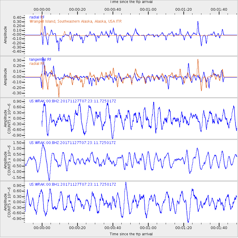
WRAK Wrangell Island, Southeastern Alaska, Alaska, USA - Earthquake Result Viewer
*The percent match for this event was below the threshold and hence no stack was calculated.
| Earthquake location: |
New Ireland Region, P.N.G. |
| Earthquake latitude/longitude: |
-4.6/153.2 |
| Earthquake time(UTC): |
2017/11/27 (331) 07:11:12 GMT |
| Earthquake Depth: |
58 km |
| Earthquake Magnitude: |
6.0 Mww |
| Earthquake Catalog/Contributor: |
NEIC PDE/us |
|
| Network: |
US United States National Seismic Network |
| Station: |
WRAK Wrangell Island, Southeastern Alaska, Alaska, USA |
| Lat/Lon: |
56.42 N/132.35 W |
| Elevation: |
81 m |
|
| Distance: |
85.3 deg |
| Az: |
32.49 deg |
| Baz: |
254.478 deg |
| Ray Param: |
$rayparam |
*The percent match for this event was below the threshold and hence was not used in the summary stack. |
|
| Radial Match: |
59.074062 % |
| Radial Bump: |
400 |
| Transverse Match: |
52.946316 % |
| Transverse Bump: |
400 |
| SOD ConfigId: |
2429771 |
| Insert Time: |
2017-12-11 07:14:49.388 +0000 |
| GWidth: |
2.5 |
| Max Bumps: |
400 |
| Tol: |
0.001 |
|
Signal To Noise
| Channel | StoN | STA | LTA |
| US:WRAK:00:BHZ:20171127T07:23:11.725017Z | 2.5961106 | 1.0045195E-6 | 3.8693247E-7 |
| US:WRAK:00:BH1:20171127T07:23:11.725017Z | 1.4346317 | 5.2416425E-7 | 3.6536503E-7 |
| US:WRAK:00:BH2:20171127T07:23:11.725017Z | 0.67742646 | 2.7450346E-7 | 4.0521516E-7 |
| Arrivals |
| Ps | |
| PpPs | |
| PsPs/PpSs | |


