You are here: Home > Network List > AV - Alaska Volcano Observatory Stations List
> Station SPCR Ckakachatna River, Mount Spurr, Alaska > Earthquake Result Viewer
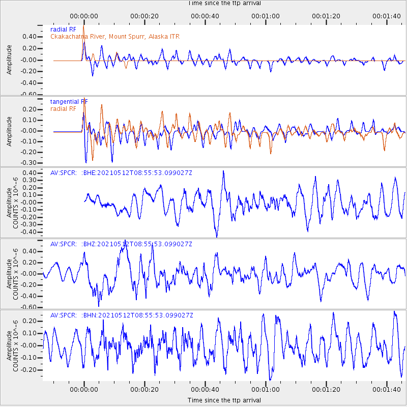
SPCR Ckakachatna River, Mount Spurr, Alaska - Earthquake Result Viewer
*The percent match for this event was below the threshold and hence no stack was calculated.
| Earthquake location: |
Near Coast Of Guatemala |
| Earthquake latitude/longitude: |
13.3/-90.2 |
| Earthquake time(UTC): |
2021/05/12 (132) 08:45:48 GMT |
| Earthquake Depth: |
46 km |
| Earthquake Magnitude: |
5.9 mww |
| Earthquake Catalog/Contributor: |
NEIC PDE/us |
|
| Network: |
AV Alaska Volcano Observatory |
| Station: |
SPCR Ckakachatna River, Mount Spurr, Alaska |
| Lat/Lon: |
61.20 N/152.21 W |
| Elevation: |
984 m |
|
| Distance: |
65.1 deg |
| Az: |
331.865 deg |
| Baz: |
108.58 deg |
| Ray Param: |
$rayparam |
*The percent match for this event was below the threshold and hence was not used in the summary stack. |
|
| Radial Match: |
54.691235 % |
| Radial Bump: |
400 |
| Transverse Match: |
63.603394 % |
| Transverse Bump: |
400 |
| SOD ConfigId: |
24890451 |
| Insert Time: |
2021-06-02 14:32:25.551 +0000 |
| GWidth: |
2.5 |
| Max Bumps: |
400 |
| Tol: |
0.001 |
|
Signal To Noise
| Channel | StoN | STA | LTA |
| AV:SPCR: :BHZ:20210512T08:55:53.099027Z | 2.832851 | 2.7696234E-7 | 9.776806E-8 |
| AV:SPCR: :BHN:20210512T08:55:53.099027Z | 1.4381403 | 1.0659493E-7 | 7.411998E-8 |
| AV:SPCR: :BHE:20210512T08:55:53.099027Z | 1.5312945 | 1.5759072E-7 | 1.02913404E-7 |
| Arrivals |
| Ps | |
| PpPs | |
| PsPs/PpSs | |


