You are here: Home > Network List > AZ - ANZA Regional Network Stations List
> Station SMER AZ.SMER > Earthquake Result Viewer
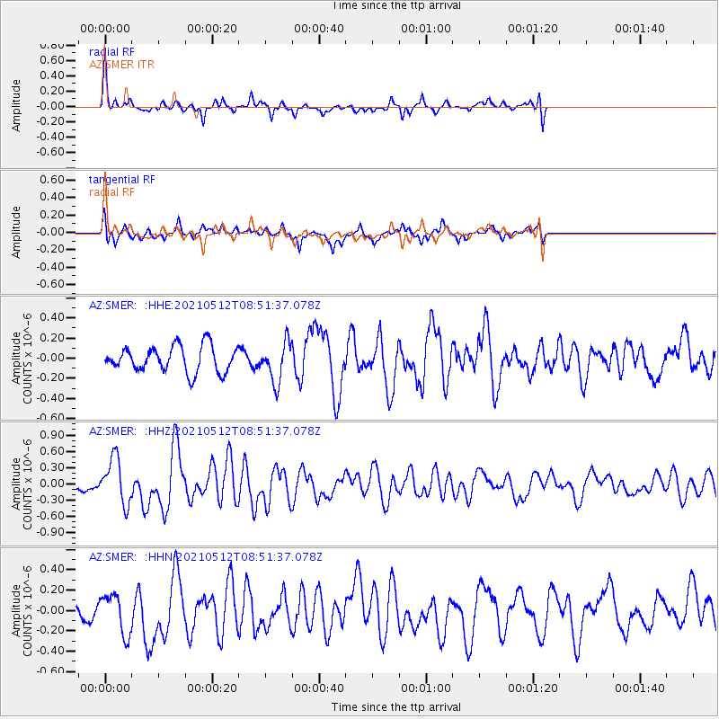
SMER AZ.SMER - Earthquake Result Viewer
*The percent match for this event was below the threshold and hence no stack was calculated.
| Earthquake location: |
Near Coast Of Guatemala |
| Earthquake latitude/longitude: |
13.3/-90.2 |
| Earthquake time(UTC): |
2021/05/12 (132) 08:45:48 GMT |
| Earthquake Depth: |
46 km |
| Earthquake Magnitude: |
5.9 mww |
| Earthquake Catalog/Contributor: |
NEIC PDE/us |
|
| Network: |
AZ ANZA Regional Network |
| Station: |
SMER AZ.SMER |
| Lat/Lon: |
33.46 N/117.17 W |
| Elevation: |
355 m |
|
| Distance: |
31.7 deg |
| Az: |
313.796 deg |
| Baz: |
122.813 deg |
| Ray Param: |
$rayparam |
*The percent match for this event was below the threshold and hence was not used in the summary stack. |
|
| Radial Match: |
67.92736 % |
| Radial Bump: |
339 |
| Transverse Match: |
67.18956 % |
| Transverse Bump: |
400 |
| SOD ConfigId: |
24890451 |
| Insert Time: |
2021-06-02 14:33:00.713 +0000 |
| GWidth: |
2.5 |
| Max Bumps: |
400 |
| Tol: |
0.001 |
|
Signal To Noise
| Channel | StoN | STA | LTA |
| AZ:SMER: :HHZ:20210512T08:51:37.078Z | 3.292355 | 4.231329E-7 | 1.2851982E-7 |
| AZ:SMER: :HHN:20210512T08:51:37.078Z | 2.4189274 | 2.0139069E-7 | 8.32562E-8 |
| AZ:SMER: :HHE:20210512T08:51:37.078Z | 1.5575426 | 1.9925938E-7 | 1.279319E-7 |
| Arrivals |
| Ps | |
| PpPs | |
| PsPs/PpSs | |


