You are here: Home > Network List > CI - Caltech Regional Seismic Network Stations List
> Station MPM Manuel Prospect Mine, California, USA > Earthquake Result Viewer
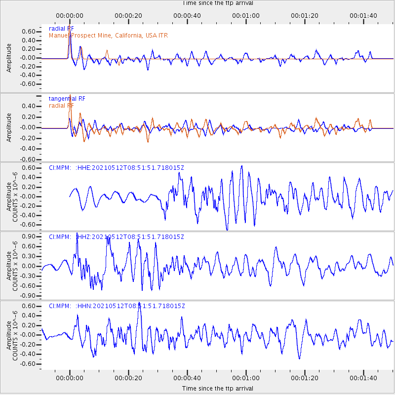
MPM Manuel Prospect Mine, California, USA - Earthquake Result Viewer
*The percent match for this event was below the threshold and hence no stack was calculated.
| Earthquake location: |
Near Coast Of Guatemala |
| Earthquake latitude/longitude: |
13.3/-90.2 |
| Earthquake time(UTC): |
2021/05/12 (132) 08:45:48 GMT |
| Earthquake Depth: |
46 km |
| Earthquake Magnitude: |
5.9 mww |
| Earthquake Catalog/Contributor: |
NEIC PDE/us |
|
| Network: |
CI Caltech Regional Seismic Network |
| Station: |
MPM Manuel Prospect Mine, California, USA |
| Lat/Lon: |
36.06 N/117.49 W |
| Elevation: |
185 m |
|
| Distance: |
33.4 deg |
| Az: |
317.509 deg |
| Baz: |
125.764 deg |
| Ray Param: |
$rayparam |
*The percent match for this event was below the threshold and hence was not used in the summary stack. |
|
| Radial Match: |
77.48549 % |
| Radial Bump: |
379 |
| Transverse Match: |
64.67778 % |
| Transverse Bump: |
400 |
| SOD ConfigId: |
24890451 |
| Insert Time: |
2021-06-02 14:36:14.119 +0000 |
| GWidth: |
2.5 |
| Max Bumps: |
400 |
| Tol: |
0.001 |
|
Signal To Noise
| Channel | StoN | STA | LTA |
| CI:MPM: :HHZ:20210512T08:51:51.718015Z | 2.0286672 | 3.262444E-7 | 1.608171E-7 |
| CI:MPM: :HHN:20210512T08:51:51.718015Z | 2.0721524 | 1.6983903E-7 | 8.196262E-8 |
| CI:MPM: :HHE:20210512T08:51:51.718015Z | 1.7033621 | 1.9205208E-7 | 1.1274883E-7 |
| Arrivals |
| Ps | |
| PpPs | |
| PsPs/PpSs | |


