You are here: Home > Network List > US - United States National Seismic Network Stations List
> Station HAWA Hanford, Washington, USA > Earthquake Result Viewer
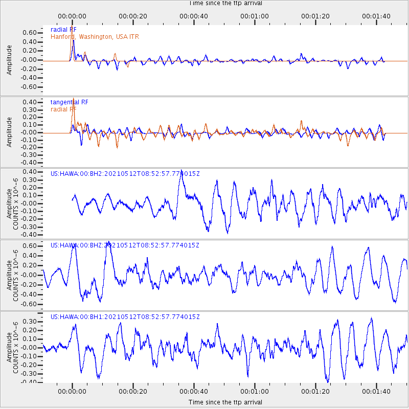
HAWA Hanford, Washington, USA - Earthquake Result Viewer
*The percent match for this event was below the threshold and hence no stack was calculated.
| Earthquake location: |
Near Coast Of Guatemala |
| Earthquake latitude/longitude: |
13.3/-90.2 |
| Earthquake time(UTC): |
2021/05/12 (132) 08:45:48 GMT |
| Earthquake Depth: |
46 km |
| Earthquake Magnitude: |
5.9 mww |
| Earthquake Catalog/Contributor: |
NEIC PDE/us |
|
| Network: |
US United States National Seismic Network |
| Station: |
HAWA Hanford, Washington, USA |
| Lat/Lon: |
46.39 N/119.53 W |
| Elevation: |
364 m |
|
| Distance: |
41.2 deg |
| Az: |
329.008 deg |
| Baz: |
133.601 deg |
| Ray Param: |
$rayparam |
*The percent match for this event was below the threshold and hence was not used in the summary stack. |
|
| Radial Match: |
60.91029 % |
| Radial Bump: |
400 |
| Transverse Match: |
38.468422 % |
| Transverse Bump: |
369 |
| SOD ConfigId: |
24890451 |
| Insert Time: |
2021-06-02 14:45:40.834 +0000 |
| GWidth: |
2.5 |
| Max Bumps: |
400 |
| Tol: |
0.001 |
|
Signal To Noise
| Channel | StoN | STA | LTA |
| US:HAWA:00:BHZ:20210512T08:52:57.774015Z | 4.0175076 | 4.1612847E-7 | 1.0357876E-7 |
| US:HAWA:00:BH1:20210512T08:52:57.774015Z | 1.7057098 | 1.7362937E-7 | 1.0179303E-7 |
| US:HAWA:00:BH2:20210512T08:52:57.774015Z | 1.5305214 | 9.274383E-8 | 6.0596236E-8 |
| Arrivals |
| Ps | |
| PpPs | |
| PsPs/PpSs | |


