You are here: Home > Network List > US - United States National Seismic Network Stations List
> Station OGNE Ogallala, Nebraska, USA > Earthquake Result Viewer
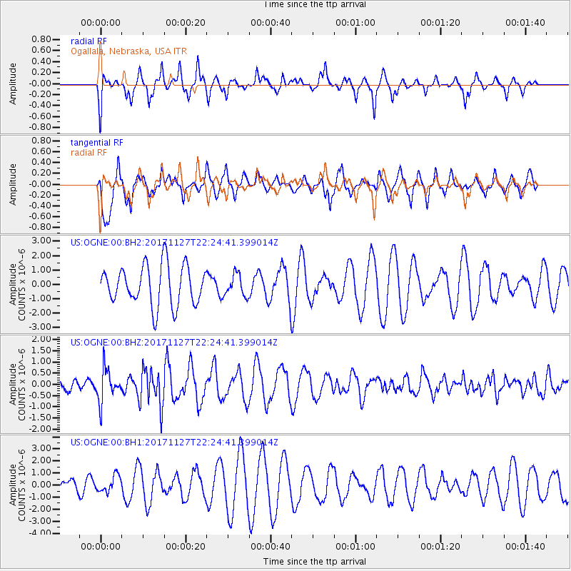
OGNE Ogallala, Nebraska, USA - Earthquake Result Viewer
*The percent match for this event was below the threshold and hence no stack was calculated.
| Earthquake location: |
Southern Alaska |
| Earthquake latitude/longitude: |
60.6/-147.4 |
| Earthquake time(UTC): |
2017/11/27 (331) 22:18:30 GMT |
| Earthquake Depth: |
16 km |
| Earthquake Magnitude: |
5.5 Mww |
| Earthquake Catalog/Contributor: |
NEIC PDE/ak |
|
| Network: |
US United States National Seismic Network |
| Station: |
OGNE Ogallala, Nebraska, USA |
| Lat/Lon: |
40.95 N/102.03 W |
| Elevation: |
1054 m |
|
| Distance: |
33.9 deg |
| Az: |
104.565 deg |
| Baz: |
320.866 deg |
| Ray Param: |
$rayparam |
*The percent match for this event was below the threshold and hence was not used in the summary stack. |
|
| Radial Match: |
56.647537 % |
| Radial Bump: |
351 |
| Transverse Match: |
83.32028 % |
| Transverse Bump: |
371 |
| SOD ConfigId: |
2429771 |
| Insert Time: |
2017-12-11 22:23:45.919 +0000 |
| GWidth: |
2.5 |
| Max Bumps: |
400 |
| Tol: |
0.001 |
|
Signal To Noise
| Channel | StoN | STA | LTA |
| US:OGNE:00:BHZ:20171127T22:24:41.399014Z | 2.1480558 | 7.4102695E-7 | 3.4497566E-7 |
| US:OGNE:00:BH1:20171127T22:24:41.399014Z | 0.84075373 | 6.87258E-7 | 8.174308E-7 |
| US:OGNE:00:BH2:20171127T22:24:41.399014Z | 0.544563 | 7.5280064E-7 | 1.3823942E-6 |
| Arrivals |
| Ps | |
| PpPs | |
| PsPs/PpSs | |


