You are here: Home > Network List > UW - Pacific Northwest Regional Seismic Network Stations List
> Station IRON Crane, OR, USA > Earthquake Result Viewer
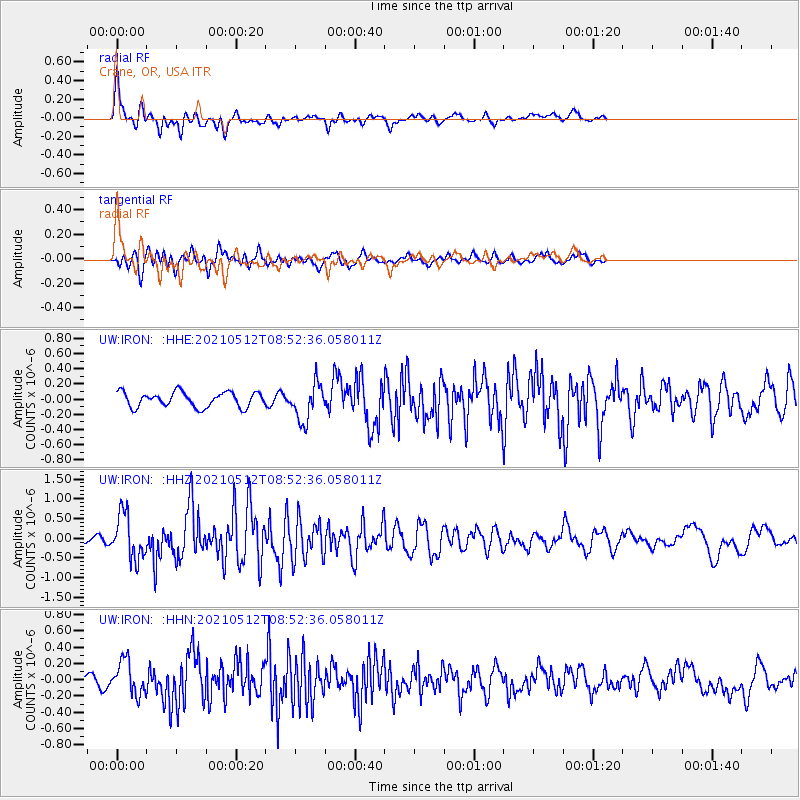
IRON Crane, OR, USA - Earthquake Result Viewer
*The percent match for this event was below the threshold and hence no stack was calculated.
| Earthquake location: |
Near Coast Of Guatemala |
| Earthquake latitude/longitude: |
13.3/-90.2 |
| Earthquake time(UTC): |
2021/05/12 (132) 08:45:48 GMT |
| Earthquake Depth: |
46 km |
| Earthquake Magnitude: |
5.9 mww |
| Earthquake Catalog/Contributor: |
NEIC PDE/us |
|
| Network: |
UW Pacific Northwest Regional Seismic Network |
| Station: |
IRON Crane, OR, USA |
| Lat/Lon: |
43.36 N/118.47 W |
| Elevation: |
1226 m |
|
| Distance: |
38.5 deg |
| Az: |
326.343 deg |
| Baz: |
132.299 deg |
| Ray Param: |
$rayparam |
*The percent match for this event was below the threshold and hence was not used in the summary stack. |
|
| Radial Match: |
78.59818 % |
| Radial Bump: |
400 |
| Transverse Match: |
70.123184 % |
| Transverse Bump: |
400 |
| SOD ConfigId: |
24890451 |
| Insert Time: |
2021-06-02 14:47:06.791 +0000 |
| GWidth: |
2.5 |
| Max Bumps: |
400 |
| Tol: |
0.001 |
|
Signal To Noise
| Channel | StoN | STA | LTA |
| UW:IRON: :HHZ:20210512T08:52:36.058011Z | 8.078913 | 5.6767084E-7 | 7.026574E-8 |
| UW:IRON: :HHN:20210512T08:52:36.058011Z | 1.9465979 | 2.0511123E-7 | 1.0536908E-7 |
| UW:IRON: :HHE:20210512T08:52:36.058011Z | 2.458196 | 2.4336745E-7 | 9.900246E-8 |
| Arrivals |
| Ps | |
| PpPs | |
| PsPs/PpSs | |


