You are here: Home > Network List > UU - University of Utah Regional Network Stations List
> Station FORU South Mineral Mountains, UT, USA > Earthquake Result Viewer
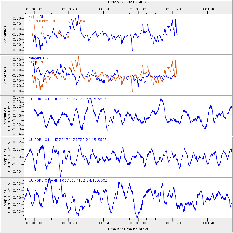
FORU South Mineral Mountains, UT, USA - Earthquake Result Viewer
*The percent match for this event was below the threshold and hence no stack was calculated.
| Earthquake location: |
Southern Alaska |
| Earthquake latitude/longitude: |
60.6/-147.4 |
| Earthquake time(UTC): |
2017/11/27 (331) 22:18:30 GMT |
| Earthquake Depth: |
16 km |
| Earthquake Magnitude: |
5.5 Mww |
| Earthquake Catalog/Contributor: |
NEIC PDE/ak |
|
| Network: |
UU University of Utah Regional Network |
| Station: |
FORU South Mineral Mountains, UT, USA |
| Lat/Lon: |
38.46 N/112.86 W |
| Elevation: |
1840 m |
|
| Distance: |
30.9 deg |
| Az: |
119.913 deg |
| Baz: |
326.95 deg |
| Ray Param: |
$rayparam |
*The percent match for this event was below the threshold and hence was not used in the summary stack. |
|
| Radial Match: |
53.184452 % |
| Radial Bump: |
400 |
| Transverse Match: |
56.19495 % |
| Transverse Bump: |
400 |
| SOD ConfigId: |
2429771 |
| Insert Time: |
2017-12-11 22:24:04.417 +0000 |
| GWidth: |
2.5 |
| Max Bumps: |
400 |
| Tol: |
0.001 |
|
Signal To Noise
| Channel | StoN | STA | LTA |
| UU:FORU:01:HHZ:20171127T22:24:15.660Z | 1.4080012 | 1.0586828E-8 | 7.5190485E-9 |
| UU:FORU:01:HHN:20171127T22:24:15.660Z | 1.1404263 | 8.189638E-9 | 7.181208E-9 |
| UU:FORU:01:HHE:20171127T22:24:15.660Z | 2.675278 | 2.8119237E-8 | 1.0510772E-8 |
| Arrivals |
| Ps | |
| PpPs | |
| PsPs/PpSs | |


