You are here: Home > Network List > G - GEOSCOPE Stations List
> Station MPG Montagne des Peres, French Guyana > Earthquake Result Viewer
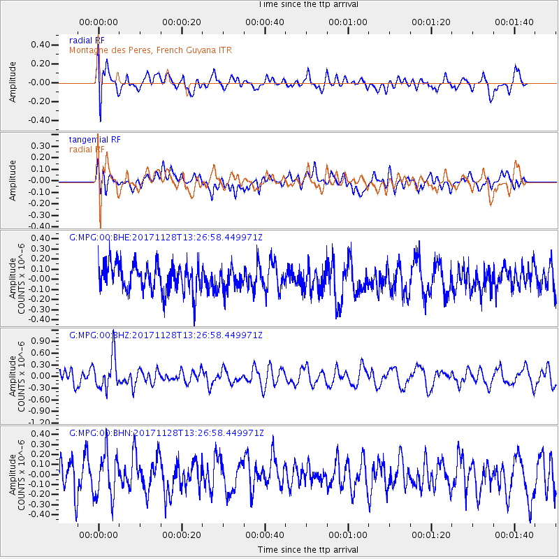
MPG Montagne des Peres, French Guyana - Earthquake Result Viewer
*The percent match for this event was below the threshold and hence no stack was calculated.
| Earthquake location: |
Norwegian Sea |
| Earthquake latitude/longitude: |
72.6/3.2 |
| Earthquake time(UTC): |
2017/11/28 (332) 13:15:46 GMT |
| Earthquake Depth: |
10 km |
| Earthquake Magnitude: |
5.6 Mww |
| Earthquake Catalog/Contributor: |
NEIC PDE/us |
|
| Network: |
G GEOSCOPE |
| Station: |
MPG Montagne des Peres, French Guyana |
| Lat/Lon: |
5.11 N/52.64 W |
| Elevation: |
147 m |
|
| Distance: |
75.4 deg |
| Az: |
238.402 deg |
| Baz: |
14.912 deg |
| Ray Param: |
$rayparam |
*The percent match for this event was below the threshold and hence was not used in the summary stack. |
|
| Radial Match: |
63.97617 % |
| Radial Bump: |
400 |
| Transverse Match: |
42.228634 % |
| Transverse Bump: |
400 |
| SOD ConfigId: |
2429771 |
| Insert Time: |
2017-12-12 13:17:18.448 +0000 |
| GWidth: |
2.5 |
| Max Bumps: |
400 |
| Tol: |
0.001 |
|
Signal To Noise
| Channel | StoN | STA | LTA |
| G:MPG:00:BHZ:20171128T13:26:58.449971Z | 2.7598808 | 4.286882E-7 | 1.5532852E-7 |
| G:MPG:00:BHN:20171128T13:26:58.449971Z | 1.7979053 | 2.2292963E-7 | 1.2399408E-7 |
| G:MPG:00:BHE:20171128T13:26:58.449971Z | 0.75200367 | 1.0540697E-7 | 1.4016817E-7 |
| Arrivals |
| Ps | |
| PpPs | |
| PsPs/PpSs | |


