You are here: Home > Network List > US - United States National Seismic Network Stations List
> Station AMTX Amarillo, Texas, USA > Earthquake Result Viewer
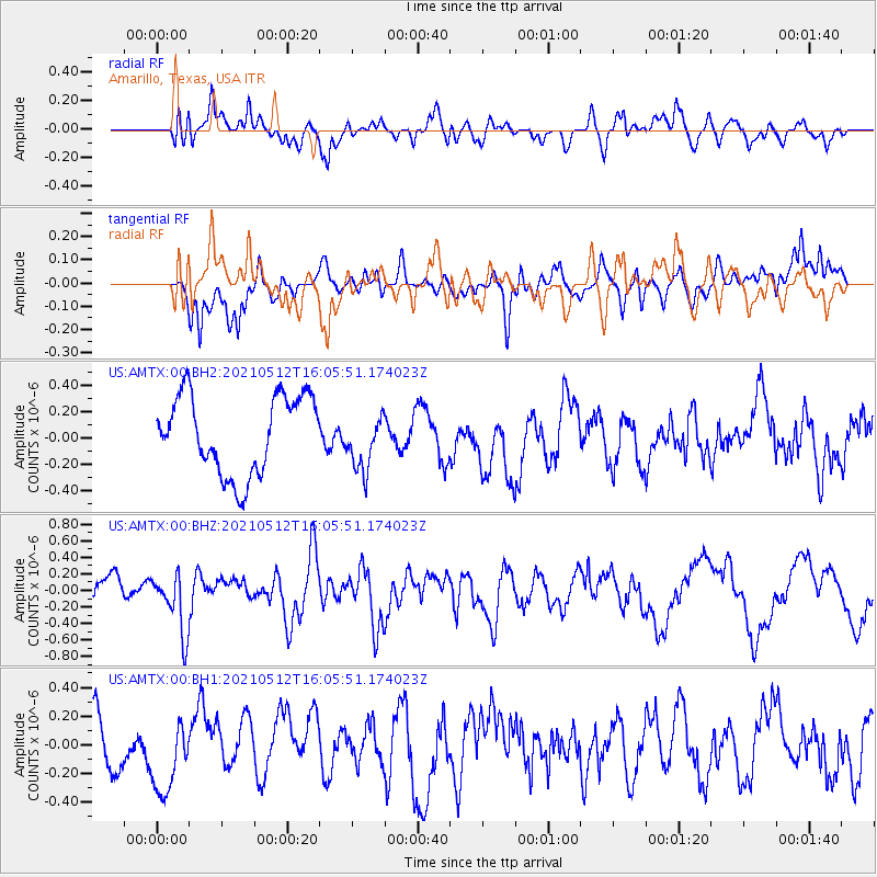
AMTX Amarillo, Texas, USA - Earthquake Result Viewer
*The percent match for this event was below the threshold and hence no stack was calculated.
| Earthquake location: |
Near Coast Of Peru |
| Earthquake latitude/longitude: |
-14.2/-75.7 |
| Earthquake time(UTC): |
2021/05/12 (132) 15:56:56 GMT |
| Earthquake Depth: |
34 km |
| Earthquake Magnitude: |
5.5 mww |
| Earthquake Catalog/Contributor: |
NEIC PDE/us |
|
| Network: |
US United States National Seismic Network |
| Station: |
AMTX Amarillo, Texas, USA |
| Lat/Lon: |
34.53 N/101.41 W |
| Elevation: |
1010 m |
|
| Distance: |
54.2 deg |
| Az: |
333.79 deg |
| Baz: |
148.74 deg |
| Ray Param: |
$rayparam |
*The percent match for this event was below the threshold and hence was not used in the summary stack. |
|
| Radial Match: |
57.014915 % |
| Radial Bump: |
400 |
| Transverse Match: |
59.19647 % |
| Transverse Bump: |
400 |
| SOD ConfigId: |
24890451 |
| Insert Time: |
2021-06-02 15:09:58.823 +0000 |
| GWidth: |
2.5 |
| Max Bumps: |
400 |
| Tol: |
0.001 |
|
Signal To Noise
| Channel | StoN | STA | LTA |
| US:AMTX:00:BHZ:20210512T16:05:51.174023Z | 1.6793447 | 3.6336698E-7 | 2.1637427E-7 |
| US:AMTX:00:BH1:20210512T16:05:51.174023Z | 1.3242211 | 2.7471543E-7 | 2.0745436E-7 |
| US:AMTX:00:BH2:20210512T16:05:51.174023Z | 0.46772486 | 1.3613308E-7 | 2.9105377E-7 |
| Arrivals |
| Ps | |
| PpPs | |
| PsPs/PpSs | |


