You are here: Home > Network List > GS - US Geological Survey Networks Stations List
> Station DEC06 Boomer > Earthquake Result Viewer
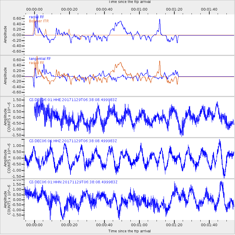
DEC06 Boomer - Earthquake Result Viewer
*The percent match for this event was below the threshold and hence no stack was calculated.
| Earthquake location: |
Near Coast Of Peru |
| Earthquake latitude/longitude: |
-14.5/-76.3 |
| Earthquake time(UTC): |
2017/11/29 (333) 06:29:05 GMT |
| Earthquake Depth: |
10 km |
| Earthquake Magnitude: |
5.7 Mww |
| Earthquake Catalog/Contributor: |
NEIC PDE/us |
|
| Network: |
GS US Geological Survey Networks |
| Station: |
DEC06 Boomer |
| Lat/Lon: |
39.90 N/88.95 W |
| Elevation: |
215 m |
|
| Distance: |
55.4 deg |
| Az: |
348.2 deg |
| Baz: |
165.079 deg |
| Ray Param: |
$rayparam |
*The percent match for this event was below the threshold and hence was not used in the summary stack. |
|
| Radial Match: |
39.440998 % |
| Radial Bump: |
400 |
| Transverse Match: |
60.951145 % |
| Transverse Bump: |
400 |
| SOD ConfigId: |
2429771 |
| Insert Time: |
2017-12-13 06:30:22.626 +0000 |
| GWidth: |
2.5 |
| Max Bumps: |
400 |
| Tol: |
0.001 |
|
Signal To Noise
| Channel | StoN | STA | LTA |
| GS:DEC06:01:HHZ:20171129T06:38:08.499983Z | 1.3301576 | 5.304264E-7 | 3.9876957E-7 |
| GS:DEC06:01:HHN:20171129T06:38:08.499983Z | 0.9715878 | 9.924854E-7 | 1.0215088E-6 |
| GS:DEC06:01:HHE:20171129T06:38:08.499983Z | 1.1826843 | 7.3061966E-7 | 6.177639E-7 |
| Arrivals |
| Ps | |
| PpPs | |
| PsPs/PpSs | |


