You are here: Home > Network List > AV - Alaska Volcano Observatory Stations List
> Station PLBL Mt. Peulik Volcano, Alaska > Earthquake Result Viewer
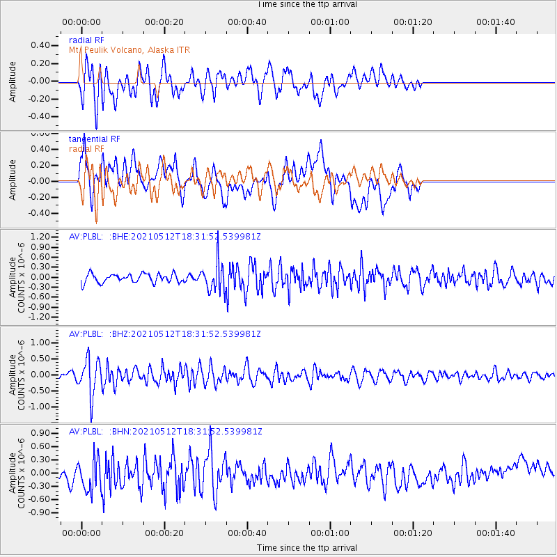
PLBL Mt. Peulik Volcano, Alaska - Earthquake Result Viewer
*The percent match for this event was below the threshold and hence no stack was calculated.
| Earthquake location: |
North Of Halmahera, Indonesia |
| Earthquake latitude/longitude: |
3.9/128.6 |
| Earthquake time(UTC): |
2021/05/12 (132) 18:20:29 GMT |
| Earthquake Depth: |
60 km |
| Earthquake Magnitude: |
5.5 mww |
| Earthquake Catalog/Contributor: |
NEIC PDE/us |
|
| Network: |
AV Alaska Volcano Observatory |
| Station: |
PLBL Mt. Peulik Volcano, Alaska |
| Lat/Lon: |
57.70 N/156.82 W |
| Elevation: |
461 m |
|
| Distance: |
78.4 deg |
| Az: |
31.887 deg |
| Baz: |
258.967 deg |
| Ray Param: |
$rayparam |
*The percent match for this event was below the threshold and hence was not used in the summary stack. |
|
| Radial Match: |
66.94534 % |
| Radial Bump: |
400 |
| Transverse Match: |
62.04354 % |
| Transverse Bump: |
400 |
| SOD ConfigId: |
24890451 |
| Insert Time: |
2021-06-02 15:18:15.411 +0000 |
| GWidth: |
2.5 |
| Max Bumps: |
400 |
| Tol: |
0.001 |
|
Signal To Noise
| Channel | StoN | STA | LTA |
| AV:PLBL: :BHZ:20210512T18:31:52.539981Z | 5.0171757 | 5.652001E-7 | 1.1265304E-7 |
| AV:PLBL: :BHN:20210512T18:31:52.539981Z | 1.7689162 | 3.8011635E-7 | 2.1488657E-7 |
| AV:PLBL: :BHE:20210512T18:31:52.539981Z | 3.4383361 | 4.498553E-7 | 1.3083516E-7 |
| Arrivals |
| Ps | |
| PpPs | |
| PsPs/PpSs | |


