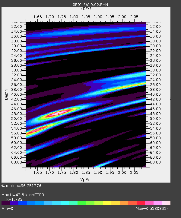
FA19 fled station 19 - Earthquake Result Viewer

Earthquake location: South Of Alaska
Earthquake latitude/longitude: 53.8/-161.1
Earthquake time(UTC): 2002/05/25 (145) 05:36:31 GMT
Earthquake Depth: 33 km
Earthquake Magnitude: 5.5 MB, 6.1 MS, 6.5 MW, 6.4 MW
Earthquake Catalog/Contributor: WHDF/NEIC
Network: XR Florida to Edmonton Seismic Experiment
Station: FA19 fled station 19
Lat/Lon: 42.51 N/95.35 W
Elevation: 390 m
Distance: 43.8 deg
Az: 77.064 deg
Baz: 308.591 deg
Ray Param: 0.0722661
Estimated Moho Depth: 47.5 km
Estimated Crust Vp/Vs: 1.74
Assumed Crust Vp: 6.53 km/s
Estimated Crust Vs: 3.764 km/s
Estimated Crust Poisson's Ratio: 0.25
Radial Match: 96.351776 %
Radial Bump: 351
Transverse Match: 73.26624 %
Transverse Bump: 400
SOD ConfigId: 248956
Insert Time: 2010-03-09 08:13:09.411 +0000
GWidth: 2.5
Max Bumps: 400
Tol: 0.001

Signal To Noise

ChannelStoNSTALTA
XR:FA19:02:BHN:20020525T05:44:03.903014Z1.1352394102.6144990.390175
XR:FA19:02:BHE:20020525T05:44:03.903014Z1.7369604112.6075564.83023
XR:FA19:02:BHZ:20020525T05:44:03.903014Z3.1471055191.3221660.793053
Arrivals
Ps5.7 SECOND
PpPs19 SECOND
PsPs/PpSs24 SECOND