You are here: Home > Network List > G - GEOSCOPE Stations List
> Station INU Inuyama, Japan > Earthquake Result Viewer
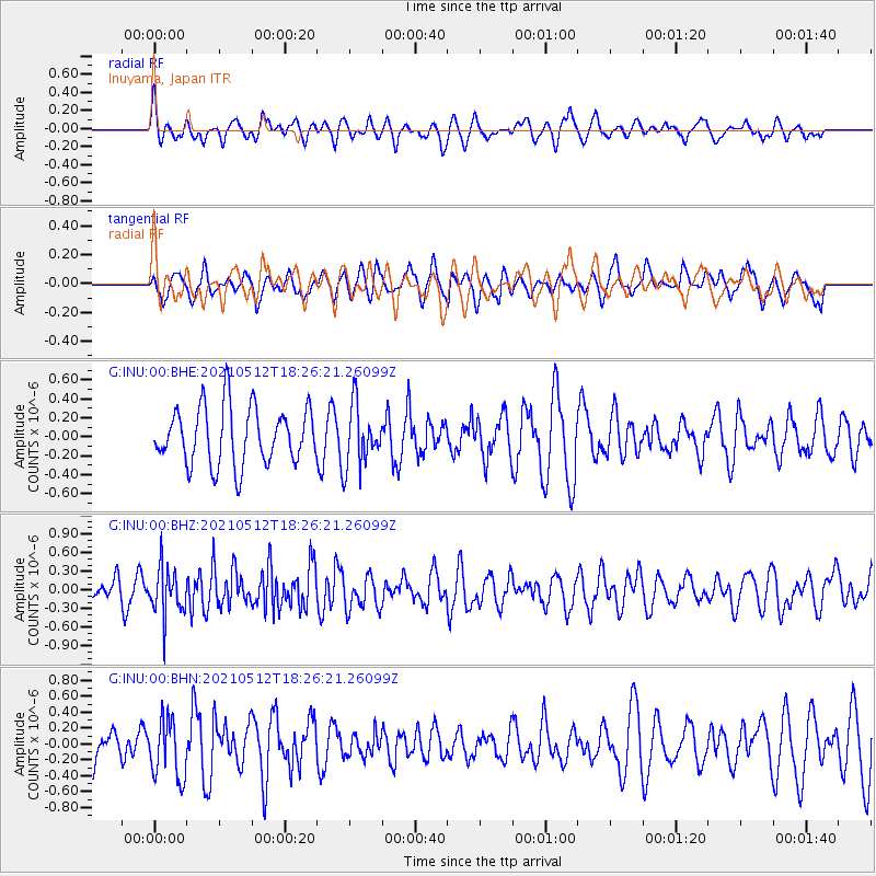
INU Inuyama, Japan - Earthquake Result Viewer
*The percent match for this event was below the threshold and hence no stack was calculated.
| Earthquake location: |
North Of Halmahera, Indonesia |
| Earthquake latitude/longitude: |
3.9/128.6 |
| Earthquake time(UTC): |
2021/05/12 (132) 18:20:29 GMT |
| Earthquake Depth: |
60 km |
| Earthquake Magnitude: |
5.5 mww |
| Earthquake Catalog/Contributor: |
NEIC PDE/us |
|
| Network: |
G GEOSCOPE |
| Station: |
INU Inuyama, Japan |
| Lat/Lon: |
35.35 N/137.03 E |
| Elevation: |
132 m |
|
| Distance: |
32.2 deg |
| Az: |
12.95 deg |
| Baz: |
195.873 deg |
| Ray Param: |
$rayparam |
*The percent match for this event was below the threshold and hence was not used in the summary stack. |
|
| Radial Match: |
45.13296 % |
| Radial Bump: |
400 |
| Transverse Match: |
50.971634 % |
| Transverse Bump: |
396 |
| SOD ConfigId: |
24890451 |
| Insert Time: |
2021-06-02 15:19:57.561 +0000 |
| GWidth: |
2.5 |
| Max Bumps: |
400 |
| Tol: |
0.001 |
|
Signal To Noise
| Channel | StoN | STA | LTA |
| G:INU:00:BHZ:20210512T18:26:21.26099Z | 2.2500703 | 3.9279104E-7 | 1.7456834E-7 |
| G:INU:00:BHN:20210512T18:26:21.26099Z | 1.228794 | 3.733834E-7 | 3.038617E-7 |
| G:INU:00:BHE:20210512T18:26:21.26099Z | 1.0579734 | 3.2094417E-7 | 3.033575E-7 |
| Arrivals |
| Ps | |
| PpPs | |
| PsPs/PpSs | |


