You are here: Home > Network List > GM - US Geological Survey Networks Stations List
> Station IWM01 Jericho 2M Well Monitoring Station > Earthquake Result Viewer
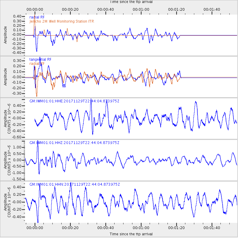
IWM01 Jericho 2M Well Monitoring Station - Earthquake Result Viewer
*The percent match for this event was below the threshold and hence no stack was calculated.
| Earthquake location: |
Kuril Islands |
| Earthquake latitude/longitude: |
45.2/146.3 |
| Earthquake time(UTC): |
2017/11/29 (333) 22:32:23 GMT |
| Earthquake Depth: |
10 km |
| Earthquake Magnitude: |
5.4 Mww |
| Earthquake Catalog/Contributor: |
NEIC PDE/us |
|
| Network: |
GM US Geological Survey Networks |
| Station: |
IWM01 Jericho 2M Well Monitoring Station |
| Lat/Lon: |
36.73 N/96.53 W |
| Elevation: |
328 m |
|
| Distance: |
80.7 deg |
| Az: |
46.397 deg |
| Baz: |
320.404 deg |
| Ray Param: |
$rayparam |
*The percent match for this event was below the threshold and hence was not used in the summary stack. |
|
| Radial Match: |
66.79367 % |
| Radial Bump: |
400 |
| Transverse Match: |
48.235294 % |
| Transverse Bump: |
400 |
| SOD ConfigId: |
2429771 |
| Insert Time: |
2017-12-13 22:33:50.720 +0000 |
| GWidth: |
2.5 |
| Max Bumps: |
400 |
| Tol: |
0.001 |
|
Signal To Noise
| Channel | StoN | STA | LTA |
| GM:IWM01:01:HHZ:20171129T22:44:04.873975Z | 3.4134648 | 5.637198E-7 | 1.6514593E-7 |
| GM:IWM01:01:HHN:20171129T22:44:04.873975Z | 1.2162243 | 2.4930378E-7 | 2.0498175E-7 |
| GM:IWM01:01:HHE:20171129T22:44:04.873975Z | 1.8262913 | 2.7099125E-7 | 1.4838336E-7 |
| Arrivals |
| Ps | |
| PpPs | |
| PsPs/PpSs | |


