KHA XW.KHA - Earthquake Result Viewer
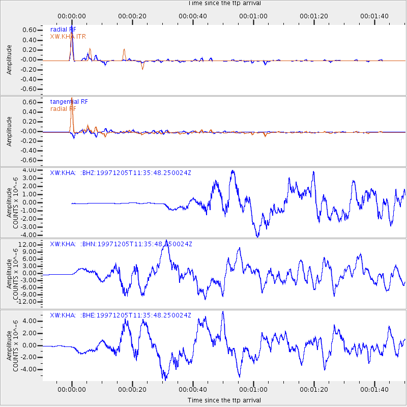
Earthquake location: Near East Coast Of Kamchatka
Earthquake latitude/longitude: 54.8/162.0
Earthquake time(UTC): 1997/12/05 (339) 11:26:54 GMT
Earthquake Depth: 33 km
Earthquake Magnitude: 6.3 MB, 7.6 MS, 7.9 UNKNOWN, 7.3 ME
Earthquake Catalog/Contributor: WHDF/NEIC
Network: XW Tien Shan Continental Dynamics
Station: KHA XW.KHA
Lat/Lon: 44.21 N/74.00 E
Elevation: 1014 m
Distance: 54.5 deg
Az: 297.981 deg
Baz: 45.26 deg
Ray Param: 0.0653672
Estimated Moho Depth: 47.25 km
Estimated Crust Vp/Vs: 1.68
Assumed Crust Vp: 6.35 km/s
Estimated Crust Vs: 3.785 km/s
Estimated Crust Poisson's Ratio: 0.22
Radial Match: 97.78403 %
Radial Bump: 212
Transverse Match: 94.92398 %
Transverse Bump: 400
SOD ConfigId: 4480
Insert Time: 2010-02-26 15:35:28.894 +0000
GWidth: 2.5
Max Bumps: 400
Tol: 0.001

Signal To Noise

ChannelStoNSTALTA
XW:KHA: :BHN:19971205T11:35:48.250024Z30.4097961.7646104E-65.8027695E-8
XW:KHA: :BHE:19971205T11:35:48.250024Z17.6818588.20878E-74.642487E-8
XW:KHA: :BHZ:19971205T11:35:48.250024Z14.2537445.507592E-73.8639616E-8
Arrivals
Ps5.3 SECOND
PpPs19 SECOND
PsPs/PpSs24 SECOND