
KHA XW.KHA - Earthquake Result Viewer
| ||||||||||||||||||
| ||||||||||||||||||
| ||||||||||||||||||
|
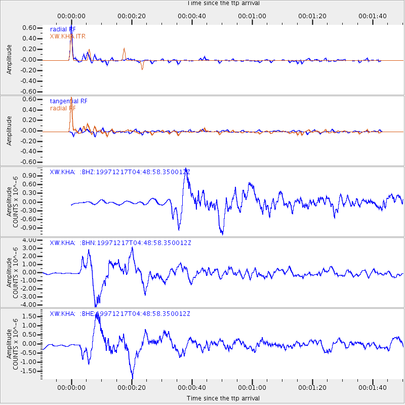
Signal To Noise
| Channel | StoN | STA | LTA |
| XW:KHA: :BHN:19971217T04:48:58.350012Z | 7.852772 | 6.85341E-7 | 8.727376E-8 |
| XW:KHA: :BHE:19971217T04:48:58.350012Z | 3.1478095 | 2.761489E-7 | 8.772733E-8 |
| XW:KHA: :BHZ:19971217T04:48:58.350012Z | 4.5475597 | 1.9175553E-7 | 4.216669E-8 |
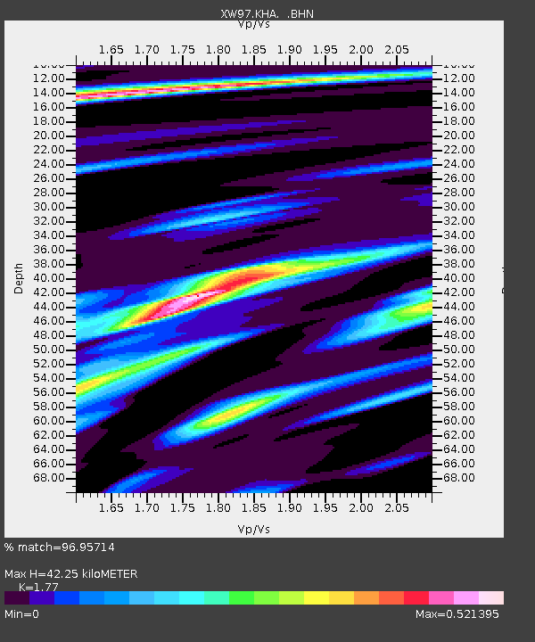
| Arrivals | |
| Ps | 5.3 SECOND |
| PpPs | 18 SECOND |
| PsPs/PpSs | 23 SECOND |

