You are here: Home > Network List > IU - Global Seismograph Network (GSN - IRIS/USGS) Stations List
> Station CTAO Charters Towers, Australia > Earthquake Result Viewer
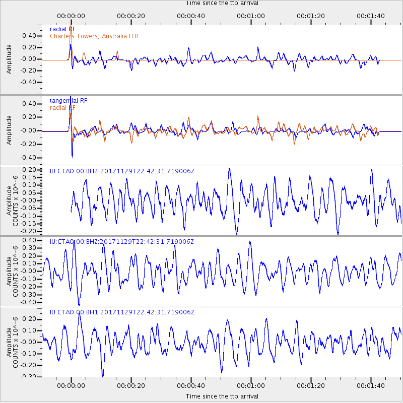
CTAO Charters Towers, Australia - Earthquake Result Viewer
*The percent match for this event was below the threshold and hence no stack was calculated.
| Earthquake location: |
Kuril Islands |
| Earthquake latitude/longitude: |
45.2/146.3 |
| Earthquake time(UTC): |
2017/11/29 (333) 22:32:23 GMT |
| Earthquake Depth: |
10 km |
| Earthquake Magnitude: |
5.4 Mww |
| Earthquake Catalog/Contributor: |
NEIC PDE/us |
|
| Network: |
IU Global Seismograph Network (GSN - IRIS/USGS) |
| Station: |
CTAO Charters Towers, Australia |
| Lat/Lon: |
20.09 S/146.25 E |
| Elevation: |
357 m |
|
| Distance: |
65.0 deg |
| Az: |
180.026 deg |
| Baz: |
0.02 deg |
| Ray Param: |
$rayparam |
*The percent match for this event was below the threshold and hence was not used in the summary stack. |
|
| Radial Match: |
50.745396 % |
| Radial Bump: |
400 |
| Transverse Match: |
59.80669 % |
| Transverse Bump: |
400 |
| SOD ConfigId: |
2429771 |
| Insert Time: |
2017-12-13 22:34:49.760 +0000 |
| GWidth: |
2.5 |
| Max Bumps: |
400 |
| Tol: |
0.001 |
|
Signal To Noise
| Channel | StoN | STA | LTA |
| IU:CTAO:00:BHZ:20171129T22:42:31.719006Z | 1.9336213 | 2.3602298E-7 | 1.2206267E-7 |
| IU:CTAO:00:BH1:20171129T22:42:31.719006Z | 1.51184 | 1.2586405E-7 | 8.325223E-8 |
| IU:CTAO:00:BH2:20171129T22:42:31.719006Z | 0.89903486 | 6.597039E-8 | 7.337912E-8 |
| Arrivals |
| Ps | |
| PpPs | |
| PsPs/PpSs | |


