You are here: Home > Network List > IU - Global Seismograph Network (GSN - IRIS/USGS) Stations List
> Station PMG Port Moresby, New Guinea > Earthquake Result Viewer
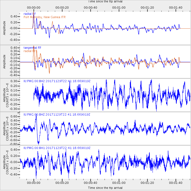
PMG Port Moresby, New Guinea - Earthquake Result Viewer
*The percent match for this event was below the threshold and hence no stack was calculated.
| Earthquake location: |
Kuril Islands |
| Earthquake latitude/longitude: |
45.2/146.3 |
| Earthquake time(UTC): |
2017/11/29 (333) 22:32:23 GMT |
| Earthquake Depth: |
10 km |
| Earthquake Magnitude: |
5.4 Mww |
| Earthquake Catalog/Contributor: |
NEIC PDE/us |
|
| Network: |
IU Global Seismograph Network (GSN - IRIS/USGS) |
| Station: |
PMG Port Moresby, New Guinea |
| Lat/Lon: |
9.40 S/147.16 E |
| Elevation: |
90 m |
|
| Distance: |
54.3 deg |
| Az: |
178.932 deg |
| Baz: |
359.234 deg |
| Ray Param: |
$rayparam |
*The percent match for this event was below the threshold and hence was not used in the summary stack. |
|
| Radial Match: |
70.666855 % |
| Radial Bump: |
400 |
| Transverse Match: |
66.28995 % |
| Transverse Bump: |
400 |
| SOD ConfigId: |
2429771 |
| Insert Time: |
2017-12-13 22:35:00.699 +0000 |
| GWidth: |
2.5 |
| Max Bumps: |
400 |
| Tol: |
0.001 |
|
Signal To Noise
| Channel | StoN | STA | LTA |
| IU:PMG:00:BHZ:20171129T22:41:18.669019Z | 4.9327517 | 4.0263933E-7 | 8.162571E-8 |
| IU:PMG:00:BH1:20171129T22:41:18.669019Z | 2.1878173 | 1.7143596E-7 | 7.8359356E-8 |
| IU:PMG:00:BH2:20171129T22:41:18.669019Z | 1.5535579 | 1.2797712E-7 | 8.237679E-8 |
| Arrivals |
| Ps | |
| PpPs | |
| PsPs/PpSs | |


