You are here: Home > Network List > IW - Intermountain West Stations List
> Station PLID Pearl Lake, Idaho, USA > Earthquake Result Viewer
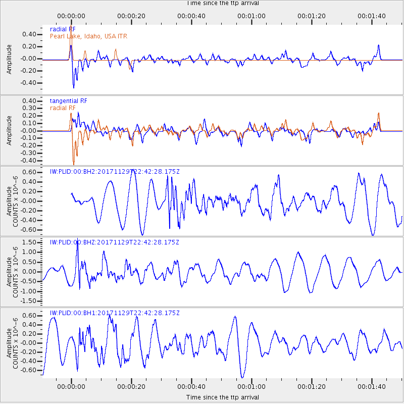
PLID Pearl Lake, Idaho, USA - Earthquake Result Viewer
*The percent match for this event was below the threshold and hence no stack was calculated.
| Earthquake location: |
Kuril Islands |
| Earthquake latitude/longitude: |
45.2/146.3 |
| Earthquake time(UTC): |
2017/11/29 (333) 22:32:23 GMT |
| Earthquake Depth: |
10 km |
| Earthquake Magnitude: |
5.4 Mww |
| Earthquake Catalog/Contributor: |
NEIC PDE/us |
|
| Network: |
IW Intermountain West |
| Station: |
PLID Pearl Lake, Idaho, USA |
| Lat/Lon: |
45.09 N/116.00 W |
| Elevation: |
2164 m |
|
| Distance: |
64.4 deg |
| Az: |
51.101 deg |
| Baz: |
309.024 deg |
| Ray Param: |
$rayparam |
*The percent match for this event was below the threshold and hence was not used in the summary stack. |
|
| Radial Match: |
55.174362 % |
| Radial Bump: |
400 |
| Transverse Match: |
57.808884 % |
| Transverse Bump: |
400 |
| SOD ConfigId: |
2429771 |
| Insert Time: |
2017-12-13 22:35:23.189 +0000 |
| GWidth: |
2.5 |
| Max Bumps: |
400 |
| Tol: |
0.001 |
|
Signal To Noise
| Channel | StoN | STA | LTA |
| IW:PLID:00:BHZ:20171129T22:42:28.175Z | 2.8758767 | 6.495664E-7 | 2.2586727E-7 |
| IW:PLID:00:BH1:20171129T22:42:28.175Z | 0.4709096 | 2.0645373E-7 | 4.3841482E-7 |
| IW:PLID:00:BH2:20171129T22:42:28.175Z | 0.7408362 | 2.5045614E-7 | 3.3807223E-7 |
| Arrivals |
| Ps | |
| PpPs | |
| PsPs/PpSs | |


