You are here: Home > Network List > US - United States National Seismic Network Stations List
> Station AGMN Agassiz National Wildlife Refuge, Minnesota, USA > Earthquake Result Viewer
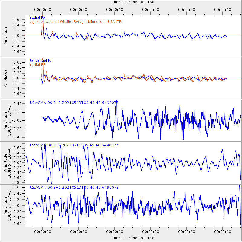
AGMN Agassiz National Wildlife Refuge, Minnesota, USA - Earthquake Result Viewer
*The percent match for this event was below the threshold and hence no stack was calculated.
| Earthquake location: |
South Of Panama |
| Earthquake latitude/longitude: |
6.8/-82.4 |
| Earthquake time(UTC): |
2021/05/13 (133) 09:42:12 GMT |
| Earthquake Depth: |
10 km |
| Earthquake Magnitude: |
6.0 mww |
| Earthquake Catalog/Contributor: |
NEIC PDE/us |
|
| Network: |
US United States National Seismic Network |
| Station: |
AGMN Agassiz National Wildlife Refuge, Minnesota, USA |
| Lat/Lon: |
48.30 N/95.86 W |
| Elevation: |
351 m |
|
| Distance: |
43.0 deg |
| Az: |
346.8 deg |
| Baz: |
160.146 deg |
| Ray Param: |
$rayparam |
*The percent match for this event was below the threshold and hence was not used in the summary stack. |
|
| Radial Match: |
71.395874 % |
| Radial Bump: |
400 |
| Transverse Match: |
59.466366 % |
| Transverse Bump: |
400 |
| SOD ConfigId: |
24890451 |
| Insert Time: |
2021-06-02 15:47:51.747 +0000 |
| GWidth: |
2.5 |
| Max Bumps: |
400 |
| Tol: |
0.001 |
|
Signal To Noise
| Channel | StoN | STA | LTA |
| US:AGMN:00:BHZ:20210513T09:49:40.649007Z | 3.8118808 | 4.9081615E-7 | 1.2875957E-7 |
| US:AGMN:00:BH1:20210513T09:49:40.649007Z | 2.461775 | 2.579559E-7 | 1.0478451E-7 |
| US:AGMN:00:BH2:20210513T09:49:40.649007Z | 2.3256693 | 2.1355088E-7 | 9.182341E-8 |
| Arrivals |
| Ps | |
| PpPs | |
| PsPs/PpSs | |


