You are here: Home > Network List > US - United States National Seismic Network Stations List
> Station CBKS Cedar Bluff, Kansas, USA > Earthquake Result Viewer
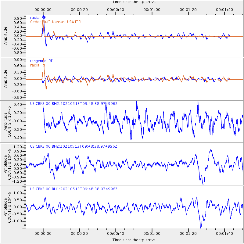
CBKS Cedar Bluff, Kansas, USA - Earthquake Result Viewer
*The percent match for this event was below the threshold and hence no stack was calculated.
| Earthquake location: |
South Of Panama |
| Earthquake latitude/longitude: |
6.8/-82.4 |
| Earthquake time(UTC): |
2021/05/13 (133) 09:42:12 GMT |
| Earthquake Depth: |
10 km |
| Earthquake Magnitude: |
6.0 mww |
| Earthquake Catalog/Contributor: |
NEIC PDE/us |
|
| Network: |
US United States National Seismic Network |
| Station: |
CBKS Cedar Bluff, Kansas, USA |
| Lat/Lon: |
38.81 N/99.74 W |
| Elevation: |
677 m |
|
| Distance: |
35.6 deg |
| Az: |
336.383 deg |
| Baz: |
149.383 deg |
| Ray Param: |
$rayparam |
*The percent match for this event was below the threshold and hence was not used in the summary stack. |
|
| Radial Match: |
78.37512 % |
| Radial Bump: |
400 |
| Transverse Match: |
51.49456 % |
| Transverse Bump: |
400 |
| SOD ConfigId: |
24890451 |
| Insert Time: |
2021-06-02 15:48:00.982 +0000 |
| GWidth: |
2.5 |
| Max Bumps: |
400 |
| Tol: |
0.001 |
|
Signal To Noise
| Channel | StoN | STA | LTA |
| US:CBKS:00:BHZ:20210513T09:48:38.974996Z | 5.269082 | 4.2775983E-7 | 8.118299E-8 |
| US:CBKS:00:BH1:20210513T09:48:38.974996Z | 2.3128254 | 3.3071854E-7 | 1.4299329E-7 |
| US:CBKS:00:BH2:20210513T09:48:38.974996Z | 1.6010414 | 1.7408146E-7 | 1.0873014E-7 |
| Arrivals |
| Ps | |
| PpPs | |
| PsPs/PpSs | |


